Catalog Archive
Auction 153, Lot 352

"Neueste Karte von Mexico Nach den Besten Quellen…", Radefeld, Carl Christian Franz

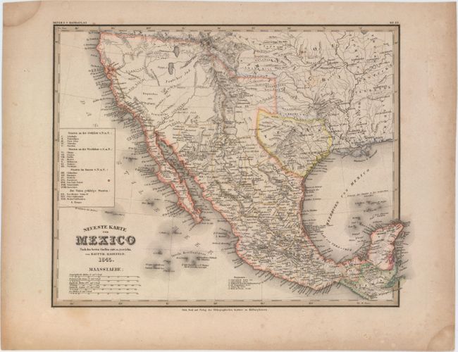
Subject: Southwestern United States & Mexico, Texas

Period: 1845 (dated)

Publication: Meyer's Hand-Atlas

Color: Hand Color

Size:
14.8 x 11.5 inches
37.6 x 29.2 cm
Download High Resolution Image
(or just click on image to launch the Zoom viewer)

The Republic of Texas was a sovereign state in North America from 1836 to 1845. It was formed as a break-away republic from Mexico by the Texas Revolution. The nation claimed a large region that included all of the present state of Texas together with part of the former Mexican region of New Mexico (parts of present-day New Mexico, Oklahoma, Kansas, Colorado, and Wyoming). The eastern boundary with the United States was defined by the Adams-Onís Treaty between the United States and Spain, in 1819. Its southern and western-most boundary with Mexico was under dispute throughout the existence of the republic, with Texas claiming that the boundary was the Rio Grande, and Mexico claiming the Nueces River as the boundary.

Attractive map covering the present-day southwestern United States and Mexico just prior to the Mexican-American War. It features a small Republic of Texas with its southwestern border following the Nueces River. Mexico is divided into its states with a key at left. The map provides excellent detail of forts, settlements, roads and the river system. Includes four distance scales.

References:

Condition: B+

Light toning and faint scattered foxing with damp stains in two corners of sheet, away from image.

Estimate: $240 - $300

Sold for: $180

Closed on 5/20/2015

Archived