Catalog Archive
Auction 153, Lot 349

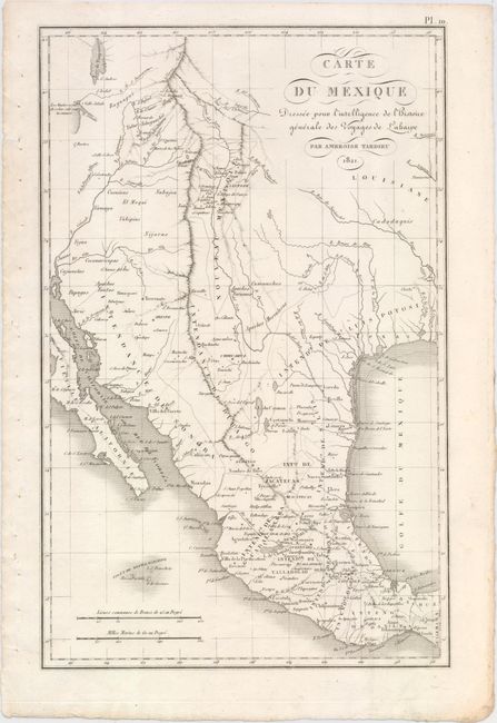
"Carte du Mexique Dressee pour l'Intelligence de l'Histoire Generale des Voyages de Laharpe", Tardieu, Ambroise
Subject: Southwestern United States & Mexico

Period: 1821 (dated)

Publication:

Color: Black & White

Size:
9.8 x 15.4 inches
24.9 x 39.1 cm
Download High Resolution Image
(or just click on image to launch the Zoom viewer)

This elegant French map spans from Bear Lake south to the Mexico-Guatemala border. Within Mexico, political divisions and numerous cities and towns are identified. In the United States, Texas is named with a few cities including San Antonio shown. Louisiane and Nouveau Mexique also appear. The Rocky Mountains are prominently featured, and the western edge of the Great Salt Lake is depicted. Throughout the map the lands of several Indian tribes are located.

References:

Condition: A+

Clean and bright with binding holes in the left blank margin.

Estimate: $240 - $325

Unsold

Closed on 5/20/2015

Archived