Catalog Archive
Auction 153, Lot 310

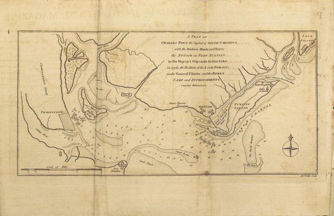
"A Plan of Charles Town the Capital of South Carolina, with the Harbour, Islands and Forts; the Attack on Fort Sulivan, by His Majesty's Ships under Sir Peter Parker, in 1776 …", Lodge, John

Subject: Charleston, South Carolina, Revolutionary War

Period: 1780 (published)

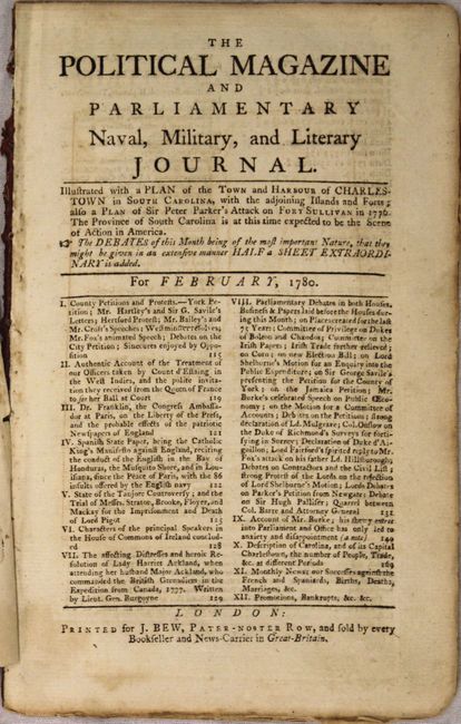
Publication: Political Magazine

Color: Black & White

Size:
11.3 x 5.5 inches
28.7 x 14 cm
Download High Resolution Image
(or just click on image to launch the Zoom viewer)

Fascinating Revolutionary War battle plan that shows the British attack on Charleston that occurred on June 28, 1776. The British fleet under Admiral Peter Parker bombarded Fort Sullivan, but was unable to destroy it and in fact were forced to retreat and withdraw to New York under heavy fire. The map locates the British 1st and 2nd brigades on Long Island, and shows the British fleet firing on Camp Sullivan while the "Rebel Ships" are located off of Charlestown Neck. The "Rebel Camp and Entrenchments" are located as well.

The map is still loosely bound into the February 1780 edition of The Political Magazine, which has a good article on South Carolina, but more importantly an article on "Sir Peter Parker’s attack on Fort Sullivan. With references to the Plan of Attack." It concludes, "Accounts are soon expected of Sir Henry Clinton’s second attempt at Charlestown. From the strong force he comes with him, and the discontents and weakness of the rebels, very few doubt of his success…" This map is uncommon, especially when accompanied by the magazine.

References: Jolly #POL-2; Nebenzahl (Biblio) #70.

Condition: B

The map has moderate offsetting, a few faint spots, and some extraneous creasing along the left fold. Text is lightly toned with a few spots of foxing.

Estimate: $700 - $850

Unsold

Closed on 5/20/2015

Archived