Catalog Archive
Auction 153, Lot 300

"Topographic Map of Long Island, New York", U.S. Geological Survey (USGS)

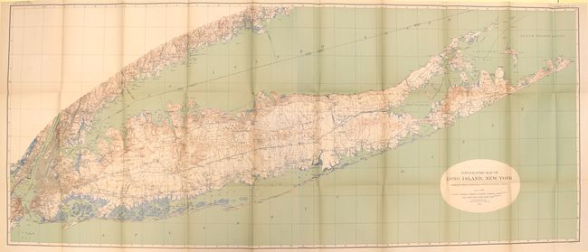
Subject: Long Island, New York

Period: 1913 (dated)

Publication:

Color: Printed Color

Size:
61.2 x 25.4 inches
155.4 x 64.5 cm
Download High Resolution Image
(or just click on image to launch the Zoom viewer)

This is a very large and detailed map with county divisions, roads, cities, towns and railroads depicted. It shows the entire island extending to include New York City, Jersey City and most of Staten Island. There is also exceptional detail along the Connecticut shoreline to Bridgeport. Contour lines are shown in brown at 20' intervals, coastal wetlands in blue, and the Atlantic Ocean and Long Island Sound in green. Lithographed by Julius Bien and joined on two sheets, as issued.

References:

Condition: A

The map is near fine with a few unobtrusive splits at fold intersections and minor toning.

Estimate: $200 - $250

Unsold

Closed on 5/20/2015

Archived