Catalog Archive
Auction 153, Lot 148

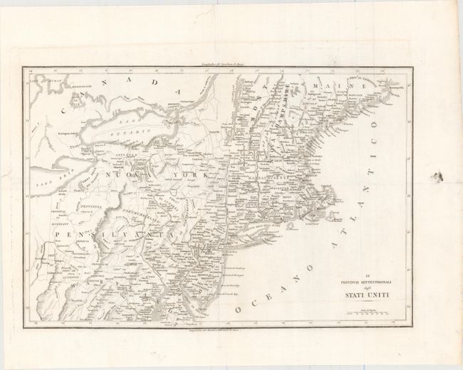
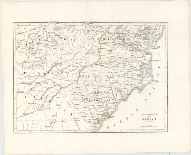
"[Lot of 2] Le Provincie Settentrionali degli Stati Uniti [with] Le Provincie Meridionali degli Stati Uniti", Anon.

Subject: Eastern United States

Period: 1826 (published)

Publication: Storia della Guerra dell'Independenza degli Stati Uniti…

Color: Black & White

Size:
17.4 x 12.4 inches
44.2 x 31.5 cm
Download High Resolution Image
(or just click on image to launch the Zoom viewer)

A very uncommon pair of Italian produced maps showing the eastern United States on two sheets. Le Provincie Settentrionali degli Stati Uniti covers the area from Maine, south to Maryland, and west to the Ohio-Pennsylvania boundary. The map has good detail of the topography, watershed and settlements of the region. Le Provincie Meridionali degli Stati Uniti covers the states of Kentucky, Virginia, Tennessee, North and South Carolina and part of Georgia. It provides a good view of early settlements and roads, as well as the mountains, forests and Indian villages. Between Tennessee and Georgia is a long strip of land labeled Territorio degli Stati Uniti. This land originally belonged to South Carolina but was ceded back to the United States in 1787, subject to Indian occupancy. Numerous Indian villages are shown, especially in the region of present-day Alabama.

References: Howes #B636.

Condition: A

Issued folding on bright watermarked paper with wide margins. There are a few faint spots in the southern sheet and a printer's smudge in the right blank margin of the northern sheet.

Estimate: $350 - $450

Unsold

Closed on 5/20/2015

Archived