Catalog Archive
Auction 152, Lot 780

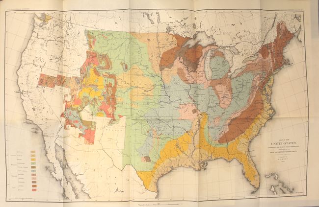
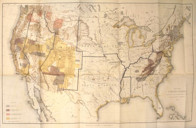
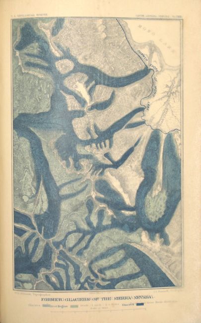
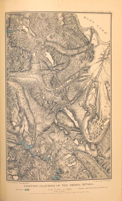
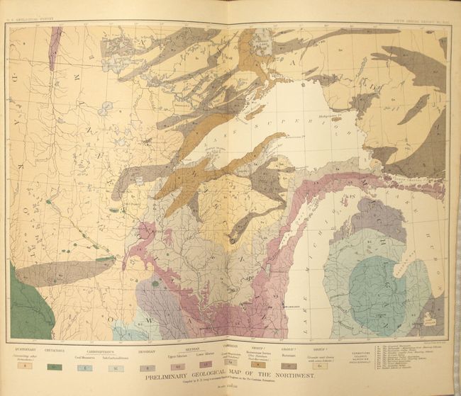
Complete in Presentation Binding with McGee Map

"[Fifth Annual Report of the United States Geological Survey]", Powell, John Wesley

Subject: Exploration and Surveys

Period: 1884 (published)

Publication: H.R. Ex. Doc. 1, 48th Congress, 2nd Session

Color: Printed Color

Size:
7.9 x 11.6 inches
20.1 x 29.5 cm
Download High Resolution Image
(or just click on image to launch the Zoom viewer)

This comprehensive report by the Director of the United States Geological Survey describes all progress and discoveries made during the fiscal year ending June 30th, 1884. The contents include the report of the Director, administrative reports from the division heads, and accompanying papers including: "The Topographic Features of Lake Shores" by Gilbert; "The Gigantic Mammals of the Order Dinocerata" by Marsh; "Existing Glaciers of the United States" by Russell; and "Sketch of Paleobotany" by Ward. In addition to the 469 pages of text are 2 folding maps, 57 plates, and numerous in-text illustrations. The maps (each 28 x 18") are:

A. Map of the United States Exhibiting the Present Status of Knowledge Relating to the Areal Distribution of Geologic Groups. This is the first published geological map of the United States by the USGS. It is generally referred to as the McGee map after the compiler. The legend at lower left names and color codes eleven different geological formations. There is also very fine detail of hydrology. Vast areas of the western U.S. remain blank, reflecting the infancy and inadequacy of western geological explorations at the time, and coincidentally emphasizing the need for more congressional funding. The mapping of the King, Hayden, Powell and Wheeler surveys are evident in the West, but little else. This was the most up-to-date map at the time, but was soon superseded by Hitchcock's 1886 map that augmented the western states' geological detail.

B. Map of the United States Exhibiting the Progress Made in the Geographic Survey. This map shows the progress of the United States geologic surveys. The primary focus is on the western states including Colorado, Utah, Nevada and California. The legend shows four different surveys: Triangulation, Area Surveyed by Geological Survey, Area Surveyed by Northern Transcontinental Survey, and Area Surveyed by other Organizations.

Hardbound in quarter calf and tips over maroon cloth with gilt title and raised bands on spine. This example, with presentation binding, was given to Representative Ira Davenport of New York, with his name in gilt at the base of the spine.

References:

Condition: A

The two large folding maps are clean and bright with light color offsetting. Text and plates are near fine with an occasional faint stain in the blank margins. The hinges are starting. Covers are very good with a little cracking along the joint, bumped edges and minor shelf wear.

Estimate: $400 - $500

Sold for: $300

Closed on 2/18/2015

Archived