Catalog Archive
Auction 152, Lot 558

"Carte Particuliere de l'Isle de Corse Divisee par Ses Dix Provinces ou Juridictions et Ses Quatre Fiefs...", Santini/Remondini
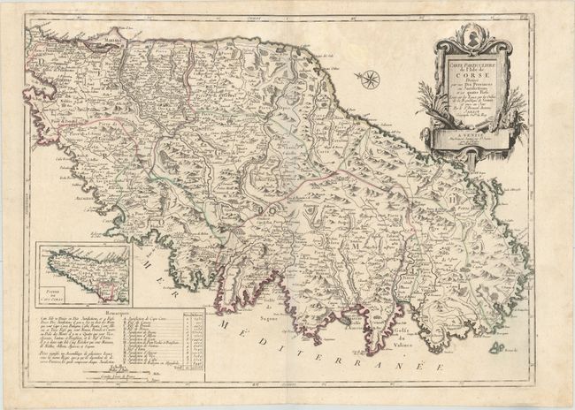
Subject: Corsica

Period: 1780 (circa)

Publication: Atlas Universel...

Color: Hand Color

Size:
25.8 x 18.9 inches
65.5 x 48 cm
Download High Resolution Image
(or just click on image to launch the Zoom viewer)

This elegantly engraved map of Corsica is based on Alexis Hubert Jaillot's map of the island. Corsica's topography is depicted in exquisite detail, and political divisions, towns and cities, and rivers are shown. Ajaccio, the largest settlement on the island, appears in miniature plan form, as do other locales, such as Calvi and Bonifacio. An inset at left focuses on the island's northern tip. Beneath the inset are notes discussing the political divisions and population figures. A gorgeous decorative title cartouche adorns the top right corner, and a compass rose capped with a fleur-de-lis orients the north to the top left corner.

References:

Condition: B+

A crisp impression and original outline color on a sturdy watermarked sheet with light damp stains along the top of the map image and minor marginal soiling. There are also a couple of short printer's creases at top of map.

Estimate: $600 - $750

Unsold

Closed on 2/18/2015

Archived