Catalog Archive
Auction 152, Lot 275

"Mexico & Guatimala with Texas", Lothian, John

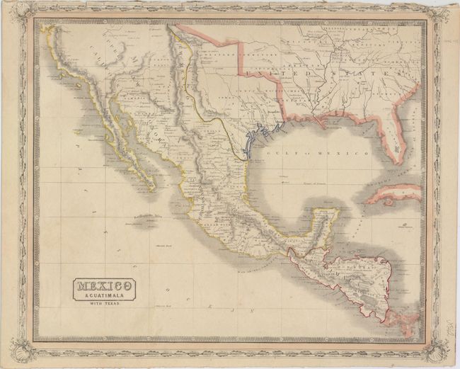
Subject: Southern United States, Mexico & Central America

Period: 1848 (published)

Publication: The People's Atlas…

Color: Hand Color

Size:
15.8 x 12.9 inches
40.1 x 32.8 cm
Download High Resolution Image
(or just click on image to launch the Zoom viewer)

The Republic of Texas was a sovereign state in North America from 1836 to 1845. It was formed as a break-away republic from Mexico by the Texas Revolution. The nation claimed a large region that included all of the present state of Texas together with part of the former Mexican region of New Mexico (parts of present-day New Mexico, Oklahoma, Kansas, Colorado, and Wyoming). The eastern boundary with the United States was defined by the Adams-Onís Treaty between the United States and Spain, in 1819. Its southern and western-most boundary with Mexico was under dispute throughout the existence of the republic, with Texas claiming that the boundary was the Rio Grande, and Mexico claiming the Nueces River as the boundary.

This uncommon, if not rare, Scottish map covers the southern United States, Mexico and Central America and features an independent Republic of Texas in its large configuration despite its 1848 publication date. According to Rumsey, this is the second edition of the map with the first being published in 1846. Surrounded by a decorative border and published in Glasgow by James MacLeod and Francis Orr & Sons.

References: Rumsey #5161.050.

Condition: B+

There is very faint color offsetting from an opposing sheet and the border is slightly trimmed at top where it was bound into the atlas with a few tiny edge tears outside the map image.

Estimate: $500 - $650

Sold for: $300

Closed on 2/18/2015

Archived