Catalog Archive
Auction 152, Lot 238

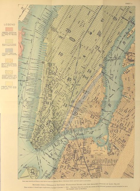
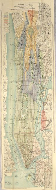
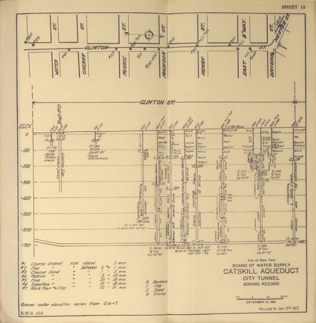
"Geological Features Affecting the Location and Plan of Construction of the City Tunnel of the Catskill Aqueduct",

Subject: New York City, New York

Period: 1912 (published)

Publication:

Color: Printed Color

Size:
6.1 x 9 inches
15.5 x 22.9 cm
Download High Resolution Image
(or just click on image to launch the Zoom viewer)

This report, prepared by Charles P. Berkey, examines the geological scenarios and implications of constructing an 18-mile distribution line from Yonkers to the Bronx, and from Manhattan to Brooklyn. It includes 3 folding plates, several in-text illustrations, and the following folding maps: Map Showing Geologic Formations Along the Proposed Lines for Distribution Conduits (46.3 x 12.2") and Revised Areal Geology of Southern Manhattan Island and the Adjacent Margin of Long Island (9.2 x 13.6"). Both of the maps vividly show the geological composition of the area with several different units identified. The large map also identifies the existing lines, new lines, and faults. The report was an excerpt from the previously issued Report of the Board of Water Supply of the City of New York on the City Tunnel.

References:

Condition: A

The two color folding maps are clean and bright. Text and folding plates are excellent with an occasional small stain in the blank margins of the text. Paper wrappers have light wear with chips to the spine.

Estimate: $275 - $350

Sold for: $210

Closed on 2/18/2015

Archived