Catalog Archive
Auction 152, Lot 205

"Land District Map of the Territory of Dakota", Rand McNally & Co.

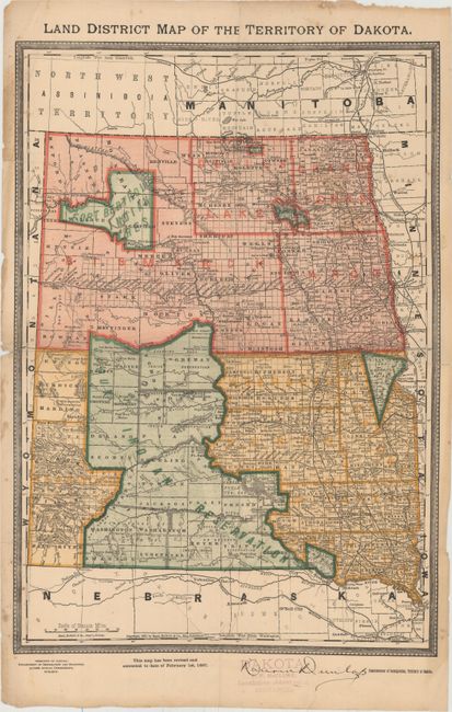
Subject: Dakota Territory

Period: 1887 (dated)

Publication:

Color: Printed Color

Size:
13.4 x 19 inches
34 x 48.3 cm
Download High Resolution Image
(or just click on image to launch the Zoom viewer)

This county map shows the extent of public surveys in the territory, with Bismarck noted as the capital. Filled with details, it includes the location of military and Indian reservations, roads, railroads, cities, towns, and more. Development is still mostly confined to the eastern half of the territory. The map was printed by Rand McNally and issued on behalf of the Commissioner of Immigration for Dakota Territory.

References:

Condition: B+

Issued folding with one tiny split at a fold intersection, one small hole along a fold, and several extraneous creases. There are a few faint stains, edge chips, and a stamp of the commissioner in the lower blank margin.

Estimate: $160 - $200

Sold for: $80

Closed on 2/18/2015

Archived