Catalog Archive
Auction 152, Lot 182

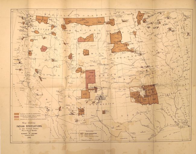
"[Map with Report] Map Showing Indian Reservations in the United States West of the 84th Meridian…", U.S. Bureau of Indian Affairs

Subject: Western United States

Period: 1881 (published)

Publication: HR Ex. Doc. 1, 47th Congress, 1st Session

Color: Printed Color

Size:
18 x 13 inches
45.7 x 33 cm
Download High Resolution Image
(or just click on image to launch the Zoom viewer)

This precisely engraved map of the western United States shows existing, proposed and "extinguished" Indian lands via a color-coded key. The map also shows Indian agencies, Army outposts, towns, railroads and Yellowstone National Park. The map is still bound into the 394 pp. annual report of the Commissioner of Indian Affairs.

References:

Condition: B+

The map has light color offsetting, a bit of foxing in the lower blank margin, and a short binding tear confined to the right blank margin. Disbound text is very good.

Estimate: $140 - $170

Sold for: $100

Closed on 2/18/2015

Archived