Catalog Archive
Auction 151, Lot 94

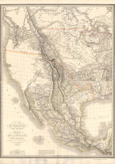
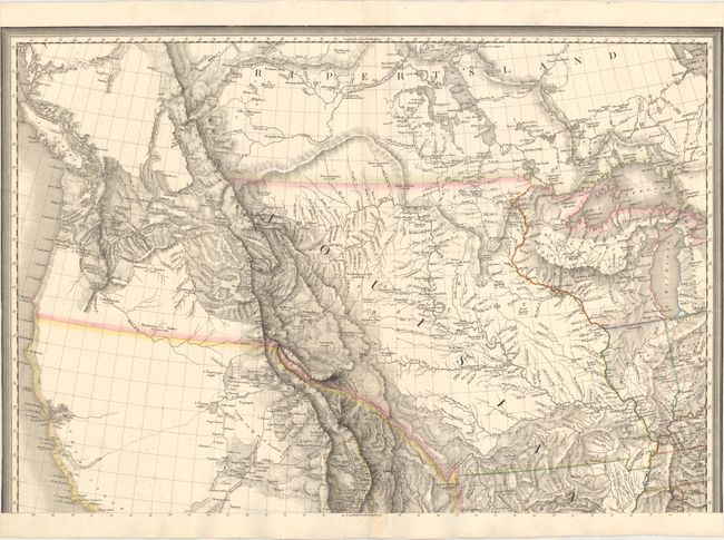
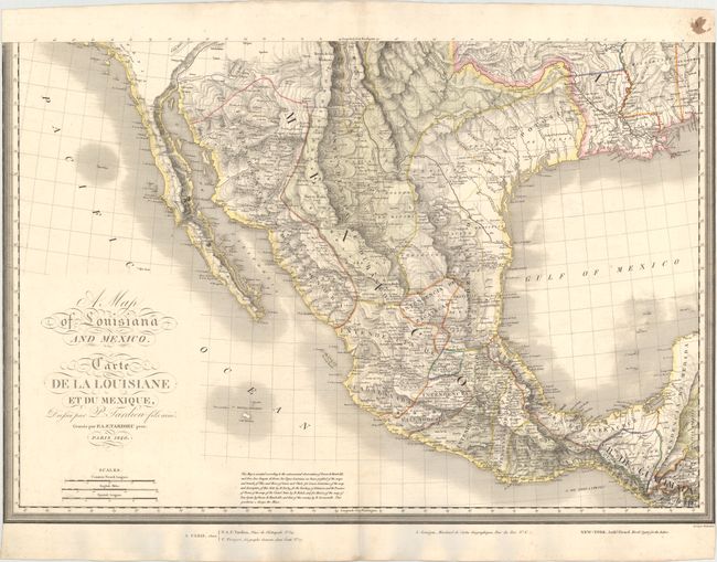
Large-Scale Map Depicting the US After the Adams-Onis Treaty

"[On 2 Sheets] A Map of Louisiana and Mexico / Carte de la Louisiane et du Mexique", Tardieu, Pierre Antoine

Subject: Western North America

Period: 1820 (dated)

Publication:

Color: Hand Color

Size:
31 x 20.9 inches
78.7 x 53.1 cm
Download High Resolution Image
(or just click on image to launch the Zoom viewer)

This highly detailed large-scale map of western North America extends north to Queen Charlotte Sound and James Bay in Canada, east just past the Mississippi River, and south to Guatemala. The map depicts the U.S. just after the settlement of its boundary with Mexico in 1819. The Adams-Onis Treaty, or Transcontinental Treaty, of 1819 was critical in defining the U.S.-Mexico boundary. In the provisions of the treaty, the U.S. ceded to Spain its claims to Texas, New Mexico and California in exchange for Spain's claims to east Florida and the Oregon Country north of the 42nd parallel (the present-day northern border of California). This map shows the new boundary between the U.S. and Mexico, and leaves the boundary between the U.S. and Canada open to the west, reflecting the joint interests in the area between the Americans and British.

There is incredible topographical detail of the Rocky Mountains, and the extensive network of rivers in the U.S. is also well defined. Towns and early roads are also identified. California and Nevada are left blank with the exception of the R. del Carmelo o S. Felipe connecting the Pacific Ocean to L. Teguayo. Both L. Teguayo and nearby L. Timpanogos are noted as "doubtful." U.S. state boundaries are identified east of the Mississippi River, including the Northwest Territory, encompassing Wisconsin and parts of Minnesota. To the west of the Mississippi River is the enormous Louisiana, which is divided into the state of Louisiana, Arkansas Territory, and Missouri Territory with an undefined western border. Present-day Texas is divided into several Mexican provinces with only a few towns noted (including S. Antonio) and one long trail crossing the state. The Red River is illustrated dipping too far south.

A note at bottom explains the cartographical sources for the map. Upper Louisiana was based on the work of Pike and Lewis and Clark, while the state of Louisiana was based on the work of William Darby. Arkansas Territory and the Province of Texas were derived from John Melish's map of the United States. Several other cartographers are also noted, including Alexander von Humboldt and Aaron Arrowsmith.

This map was published for distribution in Paris by J. Goujon and in New York by Anthony Girard. On two sheets. If joined, the map would measure approximately 31" x 43".

References:

Condition: A

A bright, clean example with original color and just a few tiny spots of foxing. Trimmed to neatlines at sides. Please note that the image of the map as a whole is a composite image - the 2 sheets are not joined.

Estimate: $3,000 - $4,000

Sold for: $5,500

Closed on 11/19/2014

Archived