Catalog Archive
Auction 151, Lot 760

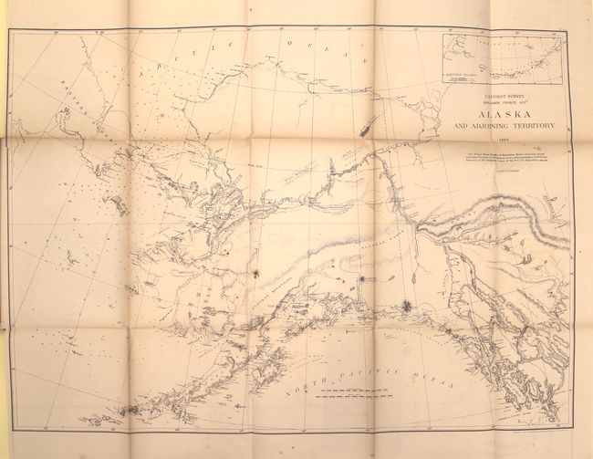
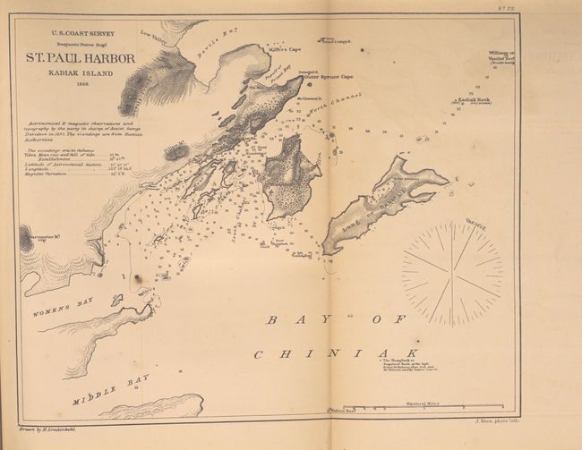
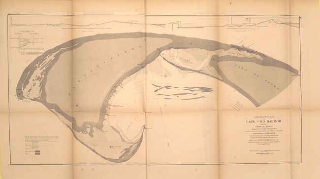
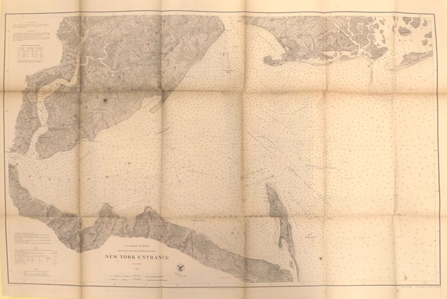
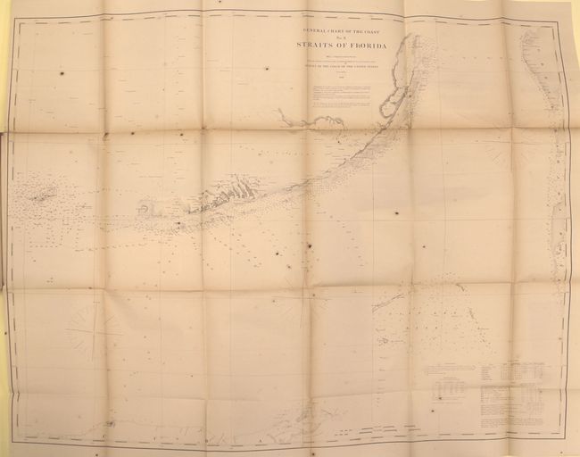
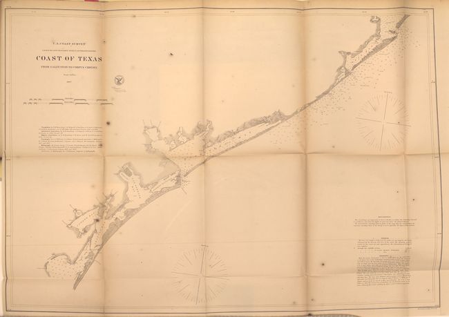
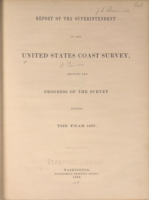
"Report of the Superintendent of the United States Coast Survey, Showing the Progress of the Survey during the Year 1867", U.S. Coast Survey

Subject: Exploration and Surveys - United States

Period: 1869 (published)

Publication: HR Ex Doc No. 275, 40th Cong., 2nd Session

Color: Black & White

Size:
9.3 x 11.7 inches
23.6 x 29.7 cm
Download High Resolution Image
(or just click on image to launch the Zoom viewer)

The Office of Coast Survey is the oldest U.S. scientific organization, dating from 1807 when Congress directed that a "survey of the coast" be carried out. By 1836, it was called the U.S. Coast Survey and in 1878, the name was changed to the U.S. Coast and Geodetic Survey. Today the Office of Coast Survey is a division of the National Oceanic and Atmospheric Administration NOAA.

The survey teams, composed of civilians as well as Army and Naval officers, charted the nation's waterways and produced a wide array of reports, survey charts, hydrographic studies of tides and currents, astronomical studies and observations, and coastal pilots. These charts are an important record of the changing nature of the nation's coastlines. In additional to coastal charts, the U.S. Coast and Geodetic Survey produced land sketches, Civil War battle maps, and the early aeronautical charts.

Very nice example of this publication detailing the progress of the Coast Survey in the year 1867. Contains numerous individual reports including a 142-page section on the Resources and Coast Features of Alaska Territory, a section on the resurvey of Galveston Bar and Harbor, Texas, and the obituary of Alexander Dallas Bache. Maps include Boston Harbor; New York entrance; Greenwich Bay, RI; Port of Newbern, NC; Straits of Florida; Galveston entrance; Tillamook Bay, OR; Puget Sound; Alaska; Sitka Harbor; and St. Paul, Kodiak Island to name a few. The four Alaska charts are among the earliest U.S. maps of Alaska following the purchase from Russia in 1867. Hardbound in brown cloth, 334 pp. with 27 maps and sketches.

References:

Condition: B+

Maps are very good with some light toning along the folds, occasional faint offsetting, and a few spots of foxing. There are library stamps on the versos of most maps and Stanford library/Branner Geological library bookplates on the inside front cover marked withdrawn. Covers and spine are excellent with minimal shelf wear.

Estimate: $400 - $500

Sold for: $275

Closed on 11/19/2014

Archived