Catalog Archive
Auction 151, Lot 692

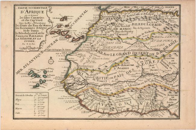
"Partie Occidentale d'Afrique ou se Trouve les Isles Canaries, et du Cap Verd dans la Mer Atlantique les Etats du Roy de Maroc...", Fer, Nicolas de

Subject: Western Africa

Period: 1700 (circa)

Publication: Atlas Curieux

Color: Hand Color

Size:
12.9 x 8.9 inches
32.8 x 22.6 cm
Download High Resolution Image
(or just click on image to launch the Zoom viewer)

This uncommon map of western Africa provides a surprising amount of information. The Canary and Cape Verde Islands are prominently featured, as are the kingdoms along the Guinee coast that were so important to European trade. The map is centered on the Tropic of Cancer and includes a compass rose, a distance scale, and a table with the latitude and longitude for various locations. The map is accompanied by a sheet of related text.

References: Pastoureau, FER I [46].

Condition: A

A fine impression on watermarked paper with a couple of tiny spots of foxing and light toning along sheet edges.

Estimate: $200 - $230

Sold for: $140

Closed on 11/19/2014

Archived