Catalog Archive
Auction 151, Lot 684

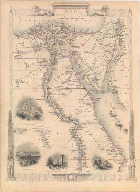
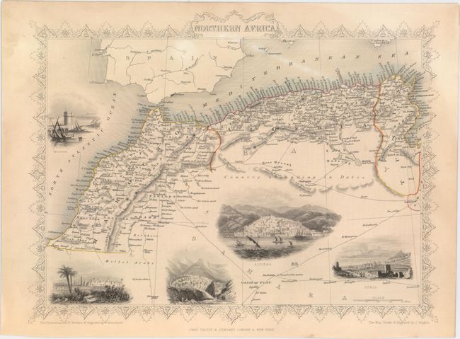
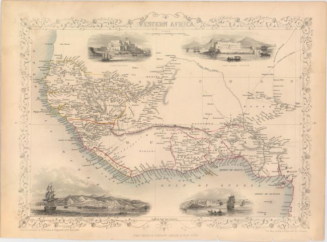
"[Lot of 3] Egypt, and Arabia Petraea [and] Northern Africa [and] Western Africa", Tallis, John

Subject: Northern & Western Africa

Period: 1850 (circa)

Publication: Illustrated Atlas and Modern History of the World

Color: Hand Color

Size:
See Description
Download High Resolution Image
(or just click on image to launch the Zoom viewer)

The maps from The Illustrated Atlas were first published in serial form to a target audience that led insular lives due to the expense and hardship of travel. All that changed as the progress of the nineteenth century brought swift and dramatic changes in public awareness of far away places. Tallis' maps no doubt played an important role in this dramatic awakening. These maps not only provided up-to-date geographical knowledge, but also used vignette views within the map's design to show the native people and their occupations, cities and points of interest. The maps hark back to a cartographic tradition from the Dutch mapmakers of the seventeenth century with finely engraved decorative borders. The maps were drawn and engraved by John Rapkin with views drawn and engraved by a number of prominent artists. The maps were issued as a complete volume from 1851 until about 1865. Some of the maps were also published in other history books published by Tallis including British Colonies and, without the vignettes, in geographical dictionaries and encyclopedias until about 1880.

A. Egypt, and Arabia Petraea, (9.9 x 13.6"). This beautiful map is surrounded in a fine illustrated border incorporating Egyptian monuments and vignettes of the Mosque of Sultan Hassan in Cairo, Alexandria, the ruins of the Karnak Temple Complex, and the Great Sphinx of Giza. It is further embellished with a fleet of fishing boats in the Red Sea. The map itself provides incredible detail including road and caravan routes. The illustrations were drawn by J. Marchant and engraved by J.B. Allen; the map was drawn and engraved by J. Rapkin.

B. Northern Africa, (13.0 x 10.0"). This lovely steel engraved map features a decorative border and vignettes of Mogador (now called Essaouira), Morocco, Constantine, Algiers, and Tunis. Many caravan routes are shown in the Sahara Desert, north of which is noted as Country abounding in Dates. The maritime states of Tunis, Algiers, and Morocco comprise the region known during this period as the Barbary Coast. The illustrations were drawn by H. Winkles and engraved by G. Greatbach; the map was drawn and engraved by J. Rapkin.

C. Western Africa, (13.5 x 9.8"). This decorative map extending from Senegal to the Bight of Biafra is filled with detail and surrounded in a delicate border. Finely engraved vignettes include Fort Christiansborg, Cape Coast Castle, Sierra Leone, and Bakel. These vignettes were drawn by H. Winkles and engraved by E. Radclyffe; the map was drawn and engraved by J. Rapkin.

References:

Condition: B+

Each map features original outline color, a couple minor spots in the images, and some toning and soiling mostly confined to the blank margins.

Estimate: $180 - $220

Sold for: $100

Closed on 11/19/2014

Archived