Catalog Archive
Auction 151, Lot 648

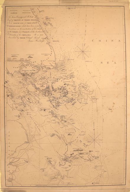
"To James Carnegy and R. Scott Esqrs. Of Prince of Wales Island as a Tribute Due for Their Valuable Communications ... This Chart of the Islands and Channels at the Southwest Extremity of the China Sea...", Horsburgh, James (Capt)

Subject: South China Sea, Singapore, Indonesia

Period: 1850 (dated)

Publication:

Color: Black & White

Size:
24.9 x 37.6 inches
63.2 x 95.5 cm
Download High Resolution Image
(or just click on image to launch the Zoom viewer)

This large sea chart of the South China Sea shows Singapore and the islands to its south. The chart is dense with detail and spans from the southern tip of the Malay Peninsula through the Singapore Strait down to Pulau Singkep and stretches east past the Bangka Strait. Depth soundings, rocks, notes on navigation and exploration, channels, banks, shoals, compasses, and hundreds of islands are shown. Several small views are included, illustrating various peaks from the vantage of the sea. Originally published in December 1821 with corrections up to 1850. Engraved by John Bateman.

References:

Condition: B+

On a slightly toned sheet with small light damp stains and scattered foxing. There are numerous small chips and short edge tears confined to the blank margins, a few of which have been closed on verso with archival tape.

Estimate: $800 - $950

Sold for: $2,200

Closed on 11/19/2014

Archived