Catalog Archive
Auction 151, Lot 626

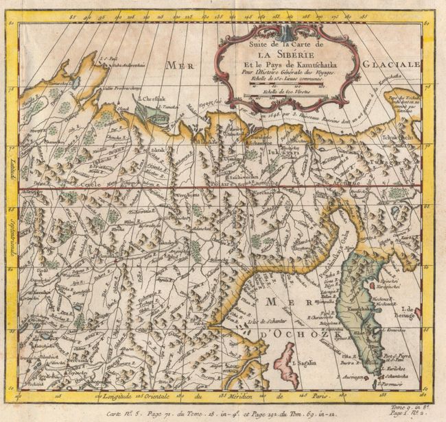
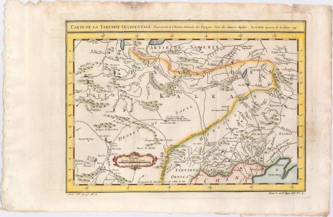
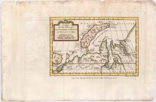
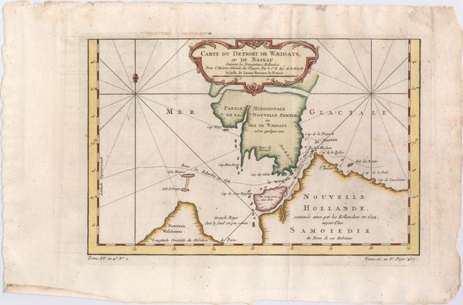
"[Lot of 4] Suite de la Carte de la Siberie et le Pays de Kamtschatka [and] Carte de la Tartarie Occidentale [and] Carte des Pais Habites par les Samojedes et Ostiacs [and] Carte du Detroit de Waeigats, ou de Nassau…", Bellin, Jacques Nicolas

Subject: Asiatic Russia

Period: 1749-58 (circa)

Publication: Prevost's Histoire Generale des Voyages

Color: Hand Color

Size:
See Description
Download High Resolution Image
(or just click on image to launch the Zoom viewer)

A. Suite de la Carte de la Siberie et le Pays de Kamtschatka (10.3 x 9.4"). Shows the northeastern part of Russia and the peninsula Kamtchatka with good detail of rivers and towns. A note along the northern coast mentions the expedition of Semyon Dezhnyov, who was the first European to sail through the Bering Strait in 1648.

B. Carte de la Tartarie Occidentale, dated 1749 (12.2 x 8.8"). This map depicts southeastern Russia extending into China. Towns, roads, rivers, and the Great Wall of China are illustrated.

C. Carte des Pais Habites par les Samojedes et Ostiacs (9.5 x 6.3"). This map shows the island of Novaya Zemlya, here named Nouvelle Zemle, off Russia's northwestern Arctic coast. The Russian mainland is shown with mountains, rivers, and inlets, and the location of the Samoyedic people is noted.

D. Carte du Detroit de Waeigats, ou de Nassau, Suivant les Navigateurs Hollandois (12.0 x 7.8"). A boldly engraved copperplate map that is centered on the Russian islands of Novaya Zemlya and Pechorskaya Guba, here Nouvelle Zemble and Grande Baye. The detailed chart shows the lower part of the island and mainland.

References:

Condition: B+

The maps are all issued folding, on watermarked paper with light offsetting and a damp stain at top.

Estimate: $200 - $230

Sold for: $100

Closed on 11/19/2014

Archived