Catalog Archive
Auction 151, Lot 544

"Paskaart van de Mont van de Witte Zee. Beginnende van Tiepena tot Pelitza...", Keulen, Johannes van

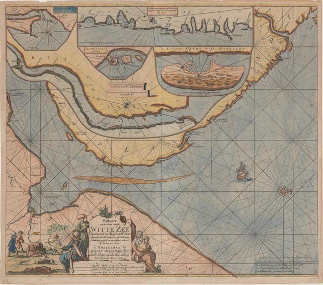
Subject: Barents & White Seas

Period: 1690 (circa)

Publication:

Color: Hand Color

Size:
22.9 x 20.2 inches
58.2 x 51.3 cm
Download High Resolution Image
(or just click on image to launch the Zoom viewer)

This very uncommon sea chart depicts the southern portion of the Barents Sea leading into the White Sea. The area labeled Laplandt represents the Kola Peninsula, and is largely obscured with 5 insets showing enlarged details of the Kola River, Lombascho, Swetenoes, the northeastern coastline of the Kola Peninsula, and Kildin Island. The map is handsomely adorned with a sailing ship, a large compass rose, and a decorative title cartouche featuring a bear hunt. North is oriented to the right.

References:

Condition: B+

On watermarked paper with light toning and minor soiling. There are a few short edge tears, two of which enter less than 1" into the map at top and have been closed on verso with archival tape.

Estimate: $650 - $800

Sold for: $450

Closed on 11/19/2014

Archived