Catalog Archive
Auction 151, Lot 462

"Eastern Portion of the English Channel Compiled from Recent English and French Surveys", Imray, James

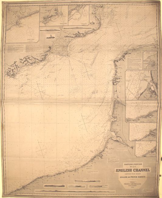
Subject: English Channel

Period: 1890 (dated)

Publication:

Color: Black & White

Size:
40 x 50.3 inches
101.6 x 127.8 cm
Download High Resolution Image
(or just click on image to launch the Zoom viewer)

This sizable blue-backed sea chart is on two joined sheets and covers the English Channel from the Strait of Dover down to La Poterie-Cap-d'Antifer on the coast of France. It features a great deal of hydrographical detail, including soundings, compasses, bottom types, lighthouses (marked with red and yellow), shoals, a plethora of navigational notes, and more. Topography, place names, railways, and the Royal Military Canal (in Britain) are shown along the coasts. There are eight inset charts: Dover, Folkstone, Ramsgate, Calais, an untitled look at Boulogne-sur-Mer and its vicinity, Dieppe, Fecamp, and Treport. Nine small views depict various land approach views and lighthouses. An alternate title, Strait of Dover, runs across the neatline at top, partially obscured by the original linen edging. North is oriented to the top left corner.

References:

Condition: B+

A dark impression with original color (red and yellow) on lighthouses. There is light soiling and toning as well as some damp stains at the edges of the image. A few notations appear in pencil.

Estimate: $350 - $450

Sold for: $150

Closed on 11/19/2014

Archived