Catalog Archive
Auction 151, Lot 35

Cellarius' Chart Showing the Island of California

"Typus Aspectuum, Oppositionum et Coniunctionum etz in Planetis", Cellarius, Andreas
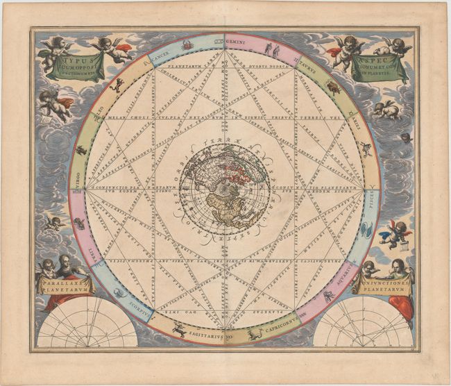
Subject: Celestial

Period: 1661 (circa)

Publication: Harmonia Macrocosmica…

Color: Hand Color

Size:
20.6 x 17.3 inches
52.3 x 43.9 cm
Download High Resolution Image
(or just click on image to launch the Zoom viewer)

The Dutch-German mathematician and cosmographer Andreas Cellarius is best known for his spectacular celestial atlas, the Harmonia Macrocosmica. His atlas contained a description of ancient and contemporary astronomy including the theories of Ptolemy, Copernicus, and Tycho Brahe. The atlas was illustrated with twenty-nine engraved plates that are among the most beautiful celestial charts ever made. The charts include illustrations of the heavens and diagrams of the orbits of the Sun, Moon, and planets according to the different cosmological theories. They were richly adorned with elaborate cartouches and baroque elements such as putti in clouds, shells, garlands, as well as portraits of famous astronomers and astronomical instruments. The Harmonia Macrocosmica was published in 1660, and reissued in 1661 by the Amsterdam publisher Johannes Jansson as a supplement to his Atlas Novus. The plates were reissued again in 1708 by the Amsterdam publishers Gerard Valk and Petrus Schenk.

This handsome chart shows the astrological aspects, such as opposition and conjunction among the planets. The chart is centered on a map of the world on a North Polar projection showing the Island of California with a rounded northern coastline. The northwest coast of North America bulges out towards Asia and is labeled N.a Albion with the place names C. Mendocina, C. Nevado, and C. Hondo. A large unnamed Rio del Norte flows southwest, and to the east several pro-English place names appear: N. England and Bermuda. A band with the twelve signs of the Zodiac surrounds the chart. The chart is embellished with a cloud background filled with putti, some holding drape-style cartouches while others hold charts. Engraved by Joannes van Loon. This is the second state, with plate number 15 at bottom right.

References: Kanas, pp. 191-94; Burden #346; McLaughlin, Celestial #4; Van der Krogt (Vol. I) #HM15:1.

Condition: A

A nice impression and superb old color with a few minor spots of printer's ink residue and an archivally repaired centerfold separation that enters 1" into map at bottom.

Estimate: $2,200 - $2,500

Sold for: $1,700

Closed on 11/19/2014

Archived