Catalog Archive
Auction 151, Lot 358

"A New and Correct Large Draught of the Tradeing Part of the West Indies", Thornton, Samuel

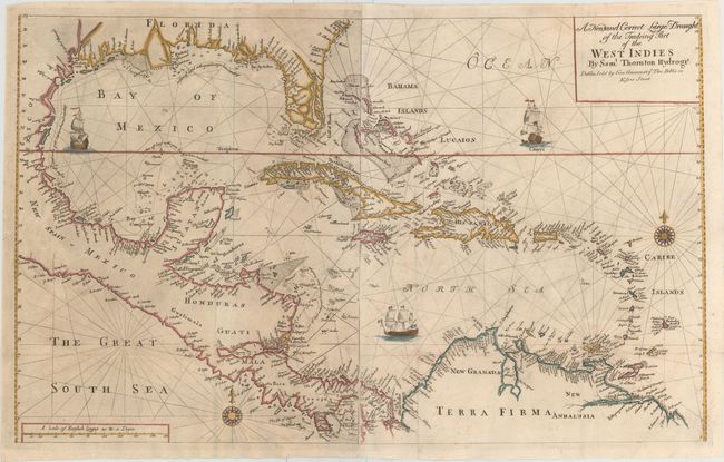
Subject: Gulf of Mexico & Caribbean

Period: 1749 (circa)

Publication: The English Pilot. Fourth Book

Color: Hand Color

Size:
32.8 x 20.1 inches
83.3 x 51.1 cm
Download High Resolution Image
(or just click on image to launch the Zoom viewer)

This two-sheet map of the Gulf of Mexico and Caribbean gives excellent detail along the coastlines. The map extends north just past the May River in present-day South Carolina. Southern Florida is depicted as a series of large islands, with a prominent R. Dais extending to the northwest. A large river and delta located where the Mississippi River should be is left unnamed, with the huge Carlile Island located at the mouth. Instead, theR. Messisepy and B. de Spirito Sancto is erroneously labeled in the area of Galveston Bay.

Place names, soundings, rocks, shoals, and anchorages are identified throughout. A dotted line along the shore of the Bay of Mexico and along the eastern coast of Nicaragua indicates the area within which soundings have been measured. The map is embellished with two compass roses and three sailing ships. This map appeared in the pirated edition of The English Pilot, published by George Grierson in 1749 and by his son, Boulter Grierson, in 1767.

This map is extremely scarce. We have found only two examples of it being offered for sale in the last 35 years, one of which was still bound in the atlas.

References: Shirley (BL Atlases) M.GRI-1a #27.

Condition: B+

A nice impression with light printer's ink residue on the western sheet. Issued folding, now pressed with very minor archival repairs along the folds.

Estimate: $2,200 - $2,500

Sold for: $1,600

Closed on 11/19/2014

Archived