Catalog Archive
Auction 151, Lot 313

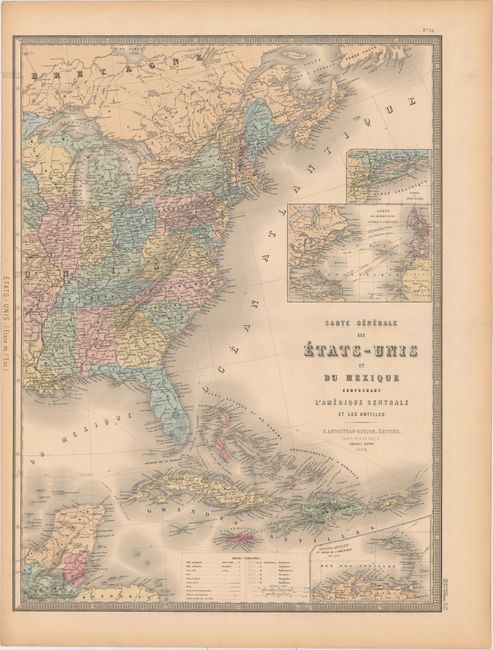
"[On 2 Sheets] Carte Generale des Etats-Unis et du Mexique Comprenant l'Amerique Centrale et les Antilles", Andriveau-Goujon, E.
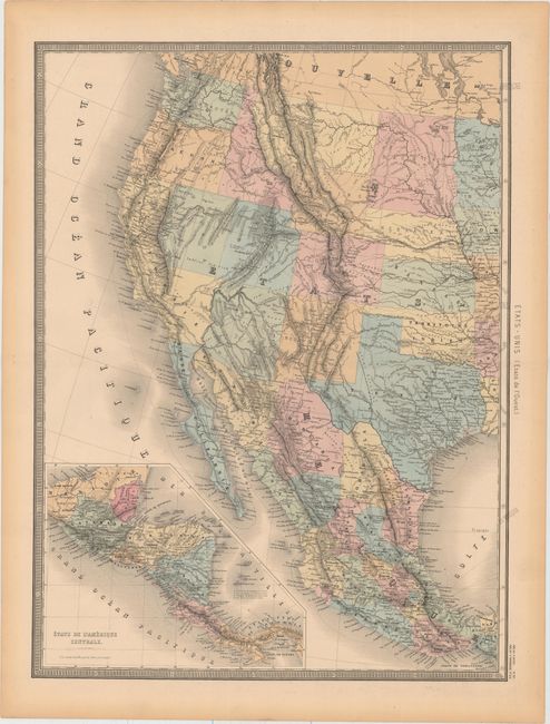
Subject: United States & Mexico

Period: 1876 (dated)

Publication: Atlas Universel

Color: Hand Color

Size:
18.3 x 24.5 inches
46.5 x 62.2 cm
Download High Resolution Image
(or just click on image to launch the Zoom viewer)

Attractive, large 19th century map of the United States, Mexico, and the West Indies with insets of Central America, Lesser Antilles, New York, and Atlantic travel and cable routes. It features a truly unusual configuration of California. The eastern boundary of California follows the Sierra Nevadas and then extends to include the southern portion of present-day Nevada, which contains Las Vegas named as Vegas de Quintana. The large Dacotah territory is shown before its division into north and south in 1889, and Oklahoma is named as Territoire Indien. The overland routes to Santa Fe, Mexico, and California are noted as well as notations of native tribes and topography. There is color key at bottom to identify the colonial possessions, but it has not been filled in.

References:

Condition: A

Original color with a hint of offsetting and toning along the sheets' edges. There are centerfold separations on the eastern sheet that are confined to the blank margin.

Estimate: $220 - $275

Sold for: $120

Closed on 11/19/2014

Archived