Catalog Archive
Auction 151, Lot 297
Rare Republic Era Map
"Texas",
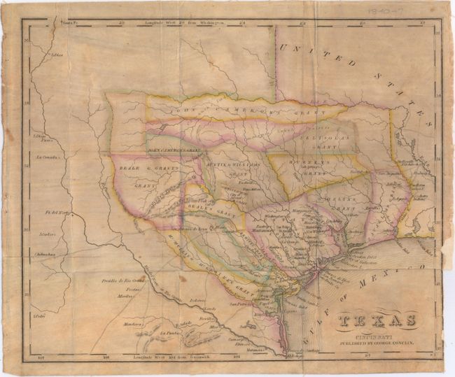
Subject: Texas
Period: 1840 (published)
Publication: The Texan Emigrant…
Color: Hand Color
Size:
11.4 x 9.4 inches
29 x 23.9 cm
Download High Resolution Image
(or just click on image to launch the Zoom viewer)
(or just click on image to launch the Zoom viewer)