Catalog Archive
Auction 151, Lot 28

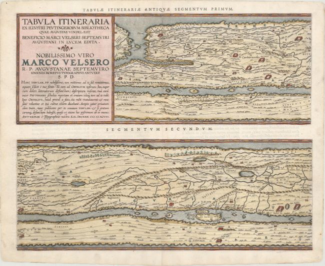
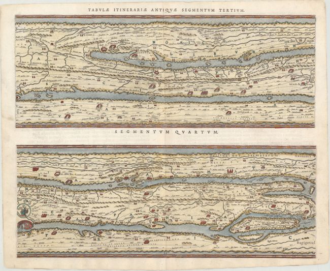
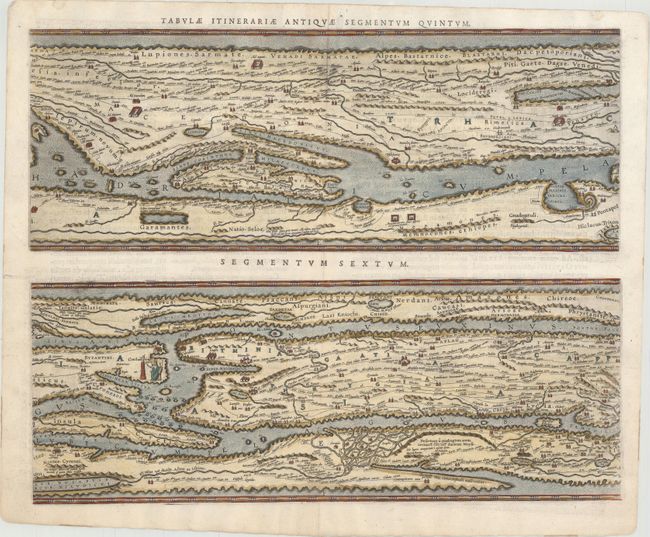
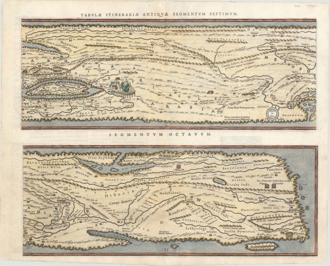
Ortelius' Scarce Peutinger Table

"[On 4 Sheets] Tabula Itineraria ex Illustri Peutingerorum Bibliotheca…Nobilissimo Viro Marco Velsero...", Ortelius, Abraham

Subject: Ancient World

Period: 1598 (dated)

Publication: Theatrum Orbis Terrarum Parergon

Color: Hand Color

Size:
20.3 x 16.2 inches
51.6 x 41.1 cm
Download High Resolution Image
(or just click on image to launch the Zoom viewer)

These four sheets are Ortelius' scarce version of the famous Peutinger Table. These decorative maps, in a sequence of four plates, each with two strip maps, depict the imperial roads and posts within the Roman Empire throughout Europe, North Africa and Asia as far as Toprobana (Sri Lanka). The format distorts the landmasses, but provides an excellent view of the cities and roads, which include distances between the posts. The three most important cities of the Roman Empire, Rome, Constantinople and Antioch, are represented by enlarged symbols including the emperor seated on a throne. Size given is for each plate.

The original parchment document for this incredible map is thought to have been made in the thirteenth century. The original now resides in the Vienna National Library, but is so damaged that the Ortelius version is now the most reliable representation. The Peutinger Table, as it is generally known, derived its name from Konrad Peutinger, who once owned the original. Ortelius had manuscript copies made in 1598 from the original scroll and supervised the engraving, but did not live to see their publication. This is the Parergon edition with Latin text on verso, printed by Balthasar Moretus and published in 1624.

References: Shirley #212; Van den Broecke #227-230.

Condition: A

Clean and bright examples with nice impressions. The fourth sheet has a tiny hole in the 7th segment caused by a paper flaw, which is only visible when held to light and has been professionally reinforced on verso.

Estimate: $7,000 - $8,500

Sold for: $5,000

Closed on 11/19/2014

Archived