Catalog Archive
Auction 151, Lot 244

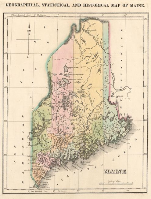
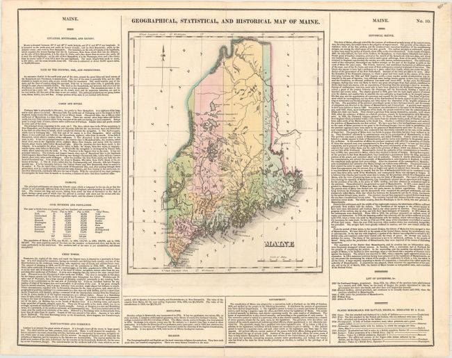
"Geographical, Statistical, and Historical Map of Maine", Carey & Lea

Subject: Maine

Period: 1822 (circa)

Publication: A Complete Historical, Chronological, and Geographical American Atlas...

Color: Hand Color

Size:
20.4 x 16.6 inches
51.8 x 42.2 cm
Download High Resolution Image
(or just click on image to launch the Zoom viewer)

This map of the new state of Maine was beautifully engraved by J. Yeager. It shows the state with only nine counties and a population of less than 300,000. There is good detail of the extensive system of lakes and rivers. Wagon roads are limited to the southern portion, most connecting the coastal towns. Bangor and Canaan, as well as many small villages are named. A handsome map on a full folio sheet (20.4 x 16.7") with surrounding text giving historical, physical, and political information. A table lists all governors current to Albion K. Parris, 1821; from 1652 to 1820, Maine was under the jurisdiction of Massachusetts.

References:

Condition: B+

Original color with archivally repaired centerfold separations at top and bottom. A previous owner has attached relevant newspaper clippings to the verso, of which there is faint show-through on recto.

Estimate: $120 - $150

Sold for: $90

Closed on 11/19/2014

Archived