Catalog Archive
Auction 151, Lot 234

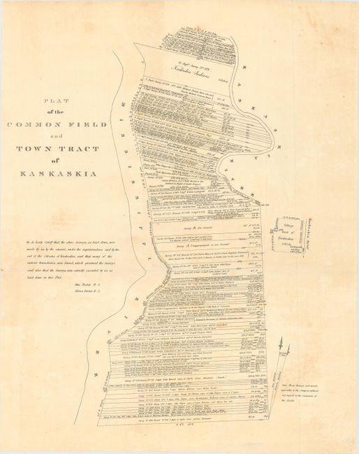
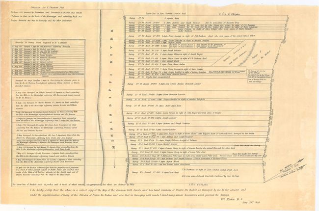
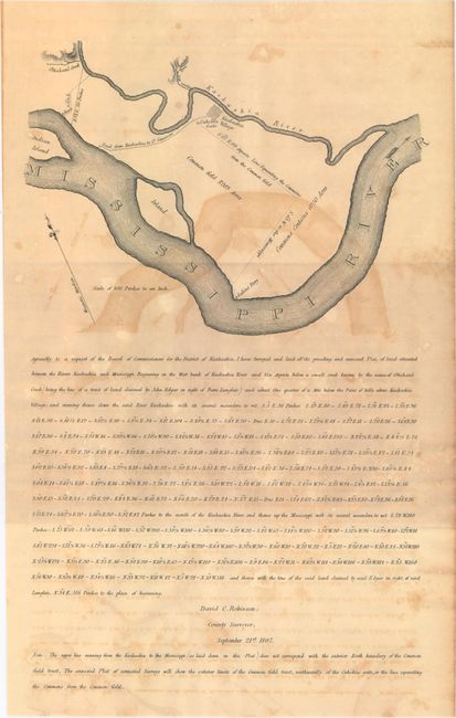
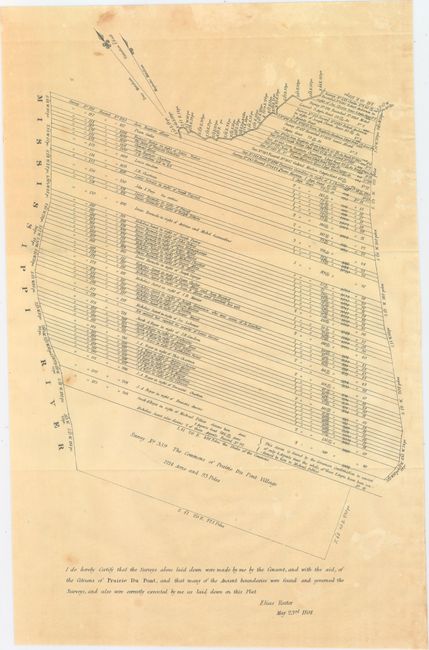
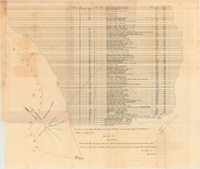
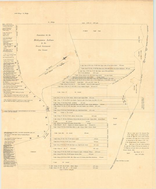
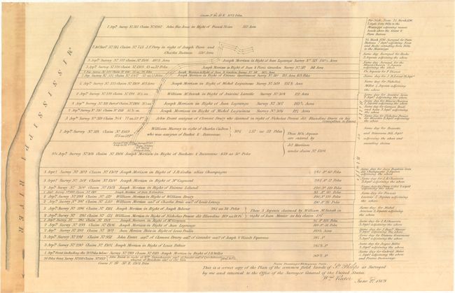
"[Lot of 8] Plat of the Common Field and Town Tract of Kaskaskia [and] Plat of the Claims Within the Tract Called the Grand Prairie [and] [6 Untitled Maps]", U.S. Government

Subject: Southern Illinois

Period: 1809-34 (circa)

Publication: American State Papers - Volume II

Color: Black & White

Size:
See Description
Download High Resolution Image
(or just click on image to launch the Zoom viewer)

This fascinating lot depicts land ownership along the banks of the Mississippi River. The tracts of land in these examples were drawn in the manner of French surveys, with long perpendicular lines to the Mississippi River (presumably allowing river access to the greatest number). Of particular interest is the Plat of the Common Field and Town Tract of Kaskaskia. In the early 18th century, Kaskasia was the French capital of Upper Louisiana due to its proximity to lead mines and its importance as a trading post. It later served as the capital of Illinois Territory and as state capital for one year (1809-1819). A large flood in 1881 caused the Mississippi River to change course, isolating Kaskaskia from the rest of Illinois and situating it as an enclave in Missouri.

These maps were originally produced circa 1809 by William and Elias Rector for the General Land Office and later issued for the American State Papers (ca. 1834). The maps include:

A. Plat of the Common Field and Town Tract of Kaskaskia (14.0 x 17.8").

B. Plat of the Claims Within the Tract Called the Grand Prairie (7.9 x 13.5").

C. [Untitled - Prairie du Rocher] (14.9 x 9.8").

D. [Untitled - Kaskaskia and Mississippi Rivers] (8.6 x 13.9").

E. [Untitled - Prairie du Pont] (9.5 x 14.7").

F. [Untitled - Cahokia] (17.0 x 14.4").

G. [Untitled - Fort Chartres] (15.4 x 16.5").

H. [Untitled - St. Philips] (14.0 x 9.6").

References:

Condition: B

Issued on sturdy paper with light toning, scattered foxing, and occasional light to moderate offsetting.

Estimate: $275 - $350

Sold for: $240

Closed on 11/19/2014

Archived