Catalog Archive
Auction 151, Lot 225

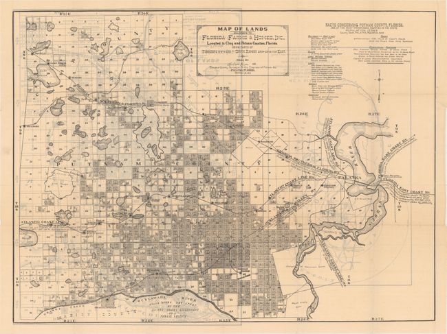
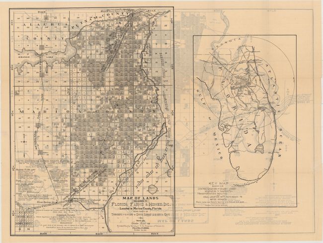
"Map of Lands Belonging to Florida Farms & Homes, Inc., Located in Clay and Putnam... [on verso] ... Located in Marion County... [and] Key Map Showing Central Location of Colony Lands... [with] Florida the Farmer's Sportsmen's and Tourist's Paradise",

Subject: Central Florida

Period: 1915 (dated)

Publication:

Color: Black & White

Size:
26.5 x 19.8 inches
67.3 x 50.3 cm
Download High Resolution Image
(or just click on image to launch the Zoom viewer)

This promotional land map depicts the holdings of Florida Farms & Homes, Inc. in Clay and Putnam counties in central Florida. The transportation network is well depicted with many railroads shown in the area including the Florida East Coast Railway, the Atlantic Coast Railway, and the Georgia Southern and Florida Railway. A table of text at top highlights some information about Putnam County including schools, churches and roads and notes that it is "one of the most progressive counties in the state." The verso contains a similar map of the company's holdings in Marion county as well as an interesting map of the state showing a series of concentric circles with distances from Palatka in Putnam County. Accompanying the map is a very attractive 67-page pamphlet filled with illustrations describing the climate, agriculture and tourism opportunities in the state.

References:

Condition: A

Map is near fine with just a few tiny spots and one small edge tear confined to the blank margin and closed on verso with archival tape. Text is very good with some light, pleasant toning. Paper covers are lightly sunned with minor soiling and a few small chips along the edges.

Estimate: $200 - $250

Sold for: $100

Closed on 11/19/2014

Archived