Catalog Archive
Auction 151, Lot 191

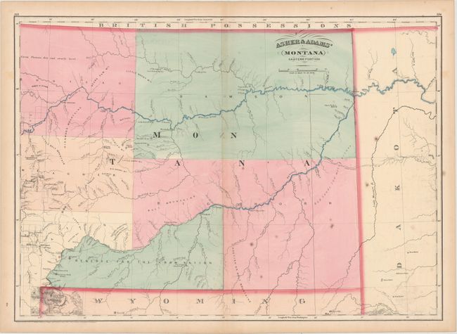
"[Lot of 2] Asher & Adams' Wyoming [and] Asher & Adams' Montana Eastern Portion", Asher & Adams

Subject: Wyoming, Montana

Period: 1874 (dated)

Publication:

Color: Hand Color

Size:
22.6 x 16 inches
57.4 x 40.6 cm
Download High Resolution Image
(or just click on image to launch the Zoom viewer)
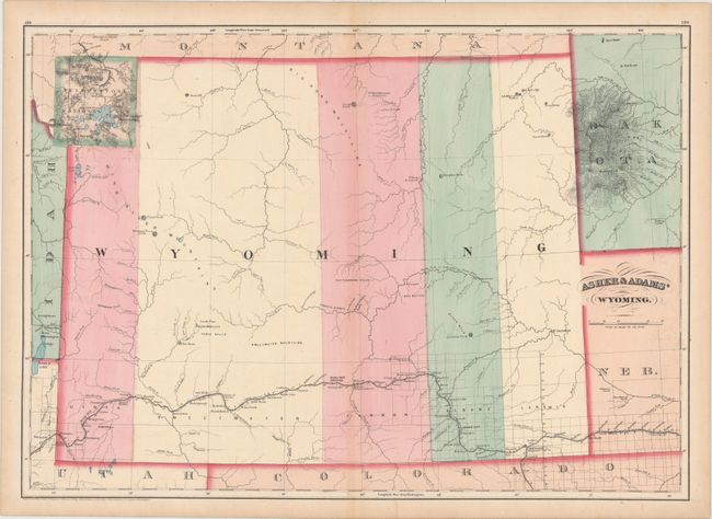
A. Asher & Adams' Wyoming. Double-page map shows the territory divided into five very large counties with the newly formed Yellowstone National Park shown in the northwestern portion of the state. Major rivers, railroads and the progress of public surveys around Cheyenne and Laramie are depicted. Condition: Faint offsetting with an edge tear at bottom that just touches the neatline and has been closed on verso with archival tape. (B+)

B. Asher & Adams' Montana Eastern Portion. Another double-page map focused on the eastern half of Montana Territory. Depicts five large counties and a "Reserve for the Crow Nation." Shows the proposed path of the Northern Pacific Railroad, the Yellowstone and Missouri rivers, and limited surveying on the western edge of the sheet. Condition: Scattered foxing and very faint offsetting. (B)

References:

Condition:

See description above.

Estimate: $250 - $325

Sold for: $180

Closed on 11/19/2014

Archived