Catalog Archive
Auction 151, Lot 18

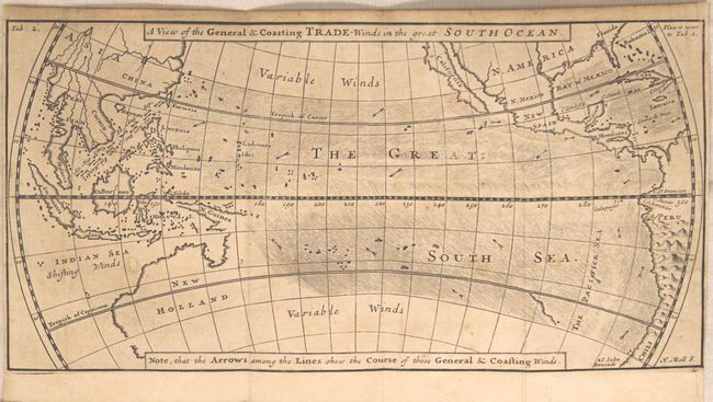
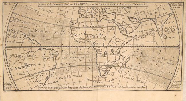
"[Lot of 2] A View of the General & Coasting Trade-Winds in the Atlantick & Indian Oceans [and] A View of the General & Coasting Trade-Winds in the Great South Ocean", Moll, Herman

Subject: World

Period: 1705 (published)

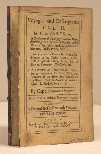
Publication: Dampier's Voyages and Descriptions

Color: Black & White

Size:
11.7 x 5.9 inches
29.7 x 15 cm
Download High Resolution Image
(or just click on image to launch the Zoom viewer)

Important pair of maps from the third edition of William Dampier's "Voyages and Descriptions." Dampier, based upon his own knowledge and information from other mariners, produced the first map of trade winds in the Pacific Ocean. He also showed that the boundary between the southeast and northeast trade winds was not the equator, but 5 degrees to the north. The map of the Pacific depicts California as an island and an incomplete coastline of Australia, which appears to be connected to New Guinea. Includes 112 pages of related text (4.8 x 7.5").

William Dampier (1652-1715) was a soldier, buccaneer, pirate, British navy captain and hydrographer. He was also among the most influential of travel writers. Dampier completed his first circumnavigation between 1679 and 1691, during which he was among the first group of Englishmen to land in New Holland (Australia).

References: Shirley (BL-Atlas) G.DAM-1a #8 & #9.

Condition: B+

The maps are lightly toned with a few spots of foxing. The map of the South Ocean has a small hole in an unengraved area to the west of Australia closed on verso with old paper. The disbound text is lightly toned with scattered foxing and the first few pages are loose.

Estimate: $400 - $500

Sold for: $325

Closed on 11/19/2014

Archived