Catalog Archive
Auction 151, Lot 17

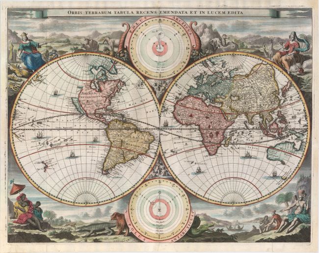
"Orbis Terrarum Tabula Recens Emendata et in Lucem Edita", Stoopendaal, Daniel

Subject: World

Period: 1702 (circa)

Publication:

Color: Hand Color

Size:
18.1 x 14 inches
46 x 35.6 cm
Download High Resolution Image
(or just click on image to launch the Zoom viewer)

This decorative double hemisphere world map was issued in a Dutch Bible published by the Keur family. It is based on Visscher's Bible map of 1663 and is surrounded by nearly identical engravings, which include numerous exotic animals and four female allegorical representations of the continents. California is depicted as an island with a flat northern coastline labeled Nova Albion. A small island in the vicinity of Alaska is labeled Anian. In Asia, the Great Wall of China is illustrated and the northeastern coastline is severely truncated. Australia, Van Diemens Landt and New Zealand have incomplete coastlines. New Guinea looks as if it may be attached to Australia. Tucked between the cusps of the map are astronomical diagrams illustrating the Copernican and Ptolemaic solar system theories. Dutch text on verso.

References: Shirley #498; Poortman & Augusteijn #130 (GII-1).

Condition: B+

A clean and bright example with a strong impression and attractive color. Issued folding with professional repairs to some small separations and tears along the centerfold within the two astronomical diagrams. Professionally remargined at left, top, and right with a minor amount of neatline replaced in facsimile.

Estimate: $1,400 - $1,700

Sold for: $1,000

Closed on 11/19/2014

Archived