Catalog Archive
Auction 151, Lot 144

"United States of America", Melish, John

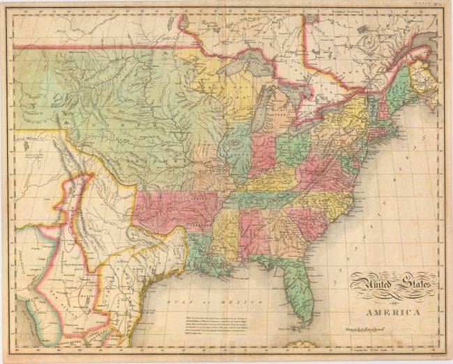
Subject: Eastern United States

Period: 1827 (circa)

Publication: Carey & Lea's American Atlas

Color: Hand Color

Size:
21.4 x 17 inches
54.4 x 43.2 cm
Download High Resolution Image
(or just click on image to launch the Zoom viewer)

This map of the United States extends west to the Rocky Mountains and provides a detailed view of the region based on information from the expeditions of Lewis & Clark and Pike. A notation at the western edge of the map shows where "Clarks Canoes stop 3000 miles from the Mississippi." The Missouri Territory takes in the entire northern plains region from the Mississippi to the Rocky Mountains. The new state of Missouri is presented with preliminary boundaries and Arkansas is shown at its largest extent. Today's Minnesota and Wisconsin are here a part of North West Territory. In Texas there are a few place names including Ft. Matagorda, but Galveston is poorly located. Texas and the Southwest are a part of Mexico. One of the most interesting features of the map is the river system in the West, near the Highest Peak, where the headwaters of several major rivers all originate within a few miles of one another - Red River of California (Colorado), Multnomah (Willamette), Rio del Norte (Rio Grande), Arkansaw (Arkansas), and the Platte. This edition includes a notation in the Gulf of Mexico explaining the sources of the map and noting that recent surveys made by Major Long have been incorporated where "the mistakes were very palpable." Engraved by Benjamin Tanner.

References: cf. Wheat [TMW] #338; Phillips (A) #1177.

Condition: B+

A nice impression with minor uneven toning, light soiling, and an edge tear at bottom that just touches the neatline and has been closed on verso with archival tape. A small piece of cello tape is located along the bottom centerfold on verso creating a faint stain on recto.

Estimate: $500 - $650

Sold for: $550

Closed on 11/19/2014

Archived