Catalog Archive
Auction 150, Lot 533

"Le Royaume de Dalmacie, Divise en Ses Comtez, Territoires etc. La Morlaquie, et la Bosnie...", Coronelli/Nolin

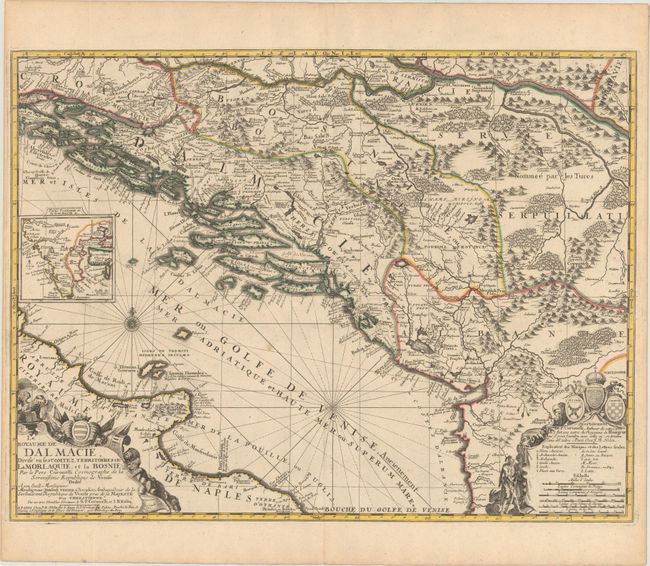
Subject: Western Balkans, Adriatic Sea

Period: 1700 (circa)

Publication:

Color: Hand Color

Size:
23.3 x 17.5 inches
59.2 x 44.5 cm
Download High Resolution Image
(or just click on image to launch the Zoom viewer)

The historic region of Dalmatia in Croatia is the focus of Coronelli's handsome map, issued by Nolin. It extends to include parts of Bosnia, Serbia, present-day Montenegro, and Albania, and Royaume de Naples appears across the Adriatic. A small inset at left depicts northern Croatia. Throughout the map, there is excellent topographical detail and plenty of place names. A key at bottom right that helps to locate bishoprics, archbishoprics, places under Turkish control, and more is encased in a beautiful cartouche embellished with the coats of arms of Bosnia, Dalmatia, and Croatia. Another cartouche for the title adorns the bottom left corner. Nicolas Guerard engraved the cartouches. Coronelli established the society of geographers "Accademia degli Argonauta", one of the oldest in the world, and became the official geographer of the Venetian Republic. His maps of the Adriatic Sea were of particular strategic and economic importance and were also often used to glorify Venice and its victories over the Turks.

References:

Condition: A

On a sturdy sheet with original outline color. There are few faint spots in the image and toning along the sheet's edges, away from map image.

Estimate: $900 - $1,200

Sold for: $400

Closed on 9/17/2014

Archived