Catalog Archive
Auction 150, Lot 463

First Postal Map of France

"Carte Geographicque des Postes qui Traversent la France Dediee", Tavernier, Melchior
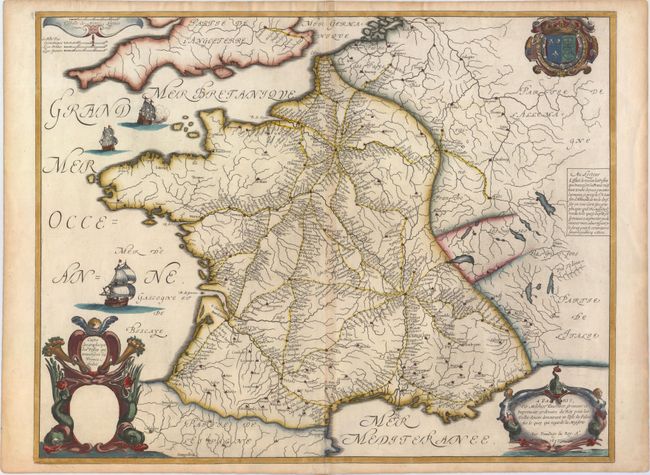
Subject: France

Period: 1632 (dated)

Publication: Theatre Geographique du Royaume de France

Color: Hand Color

Size:
21 x 16.3 inches
53.3 x 41.4 cm
Download High Resolution Image
(or just click on image to launch the Zoom viewer)

This is the first postal map of France. Each route is shown in great detail with all postal stops named. The routes leave Paris in a spider-like pattern with eight spokes and extend throughout the county as far south as Nice. With three decorative cartouches including the title, imprint, and a distance scale. The dedication portion of the decorative title cartouche is blank. Further embellished with the royal coat of arms at upper right and three ships under full sail at left. Tavernier's imprint states "Avec Privillege du Roy." A note at right describes the postal system.

References: Pastoureau, Tavernier II C #80.

Condition: B+

A fine impression with attractive color on watermarked paper and light toning along centerfold. A couple of tiny tears confined to bottom blank margin have been archivally repaired.

Estimate: $600 - $750

Sold for: $325

Closed on 9/17/2014

Archived