Catalog Archive
Auction 150, Lot 329

"Insulae Americanae in Oceano Septentrionali ac Regiones Adiacentes, a C. de May Usque ad Lineam Aequinoctialem", Visscher, Nicolas

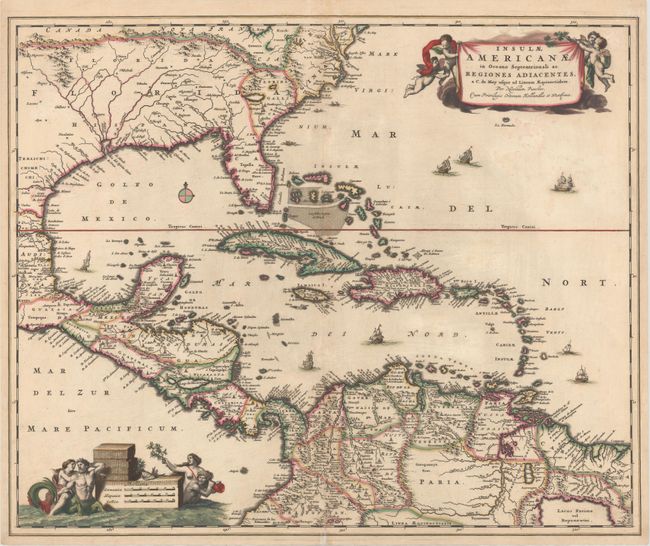
Subject: Gulf of Mexico and Caribbean

Period: 1682 (circa)

Publication:

Color: Hand Color

Size:
22.3 x 18.3 inches
56.6 x 46.5 cm
Download High Resolution Image
(or just click on image to launch the Zoom viewer)

This handsome map focuses on the West Indies and covers the region from the Chesapeake through the Gulf of Mexico, with Central America and the northern part of South America. Two lovely cartouches with cherubs and mermaids decorate opposite corners. Eight ships sail the seas and three native canoes are depicted off the coast of North America. A number of interesting cartographic myths appear on the map. These include two large nonexistent lakes in the region of western Georgia and a non-existent mountain range extending from the Piedmonts bearing across the North American continent. In South America, the archetypal cartographic myth, Manoa o' El Dorado (the golden city), is located on the shores of the Lacus Parime vel Roponowini in Guyana. This is the second state with the addition of the privilege in the cartouche.

References: Burden #531; Portinaro & Knirsch #82.

Condition: B+

A fine impression with splendid original color. There is a small abrasion along the centerfold in Colombia, a faint damp stain below the title cartouche, and an archivally repaired centerfold separation that enters 2" into map at bottom.

Estimate: $1,400 - $1,700

Sold for: $900

Closed on 9/17/2014

Archived