Catalog Archive
Auction 150, Lot 173

"Eldridge's Chart No. 11. Delaware Bay and River. From the United States Coast and George Eldridge's Surveys", Eldridge, George

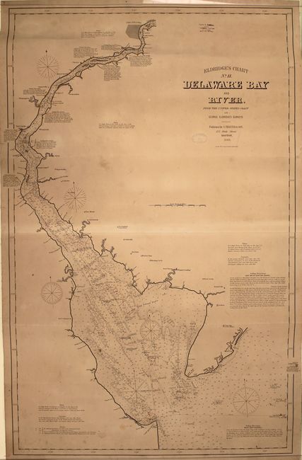
Subject: Delaware Bay

Period: 1889 (dated)

Publication:

Color: Black & White

Size:
30.6 x 47.2 inches
77.7 x 119.9 cm
Download High Resolution Image
(or just click on image to launch the Zoom viewer)

This large linen-backed sea chart shows the Delaware Bay from its mouth up to just north of Philadelphia. It is dense with hydrographical information, including soundings, shoals, lighthouses, buoys, compass roses, shoals, sailing directions, and notes on tides and currents. Dotted lines on the chart give sailors the distance and sailing directions between ports and numerous buoys or other intersections. Some towns and cities appear inland as block plans, among them Philadelphia, Wilmington, Delaware City, and Greenwich. On verso is the original paper label with title, with a price of $3.00, a panel displaying the medals won by Eldridge's Charts at the Massachusetts Mechanics Fair in 1881, and a list of the other charts in the series. Published by S. Thaxter & Son, whose stamp appears on the chart, dated 1890. Another stamp, for Charles A. Harriman, a dealer of charts and other nautical goods based in Maine, is located in an unengraved area at top. Large-scale nautical charts are generally rare on the market today due to the fact that they were used in a damp, rough environment and generally discarded as updated versions became available.

References:

Condition: B

A crisp impression on a moderately toned sheet with light soiling, faint scattered foxing, and a couple small damp stains.

Estimate: $1,300 - $1,600

Sold for: $800

Closed on 9/17/2014

Archived