Catalog Archive
Auction 150, Lot 138

"Partie Orientale de la Nouvelle France ou du Canada avec l'Isle de Terre-Neuve et de Nouvelle Escosse, Acadie et Nouv. Angleterre avec Fleuve de St. Laurence", Seutter/Lotter

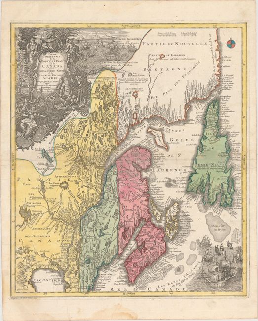
Subject: Colonial New England & Canada

Period: 1740 (circa)

Publication:

Color: Hand Color

Size:
19.6 x 22.7 inches
49.8 x 57.7 cm
Download High Resolution Image
(or just click on image to launch the Zoom viewer)

A beautiful map of Maine and northeastern Canada, including Nova Scotia, Labrador and Newfoundland. This is the second state of the map originally drawn by Seutter and engraved by Lotter, with Lotter's imprint in the title cartouche. The map's vertical format elongates the geography, which distorts Newfoundland and depicts the St. Lawrence River running nearly north-south. It is very detailed, especially along the coastlines and rivers with many place names noted, both European and Indian, including Casco Bay (Baye de Casco), the Penobscot River, Wells, and Cape Elizabeth. At bottom right is a scene with several sailing ships. At top left is a huge decorative title cartouche featuring allegorical figures, Indian chiefs, explorers, mapmakers, a fleet of ships, fishermen and wildlife.

References:

Condition: B+

Original color with a few soft creases, minor soiling, and a faint damp stain that enters the map at bottom left.

Estimate: $1,000 - $1,300

Sold for: $575

Closed on 9/17/2014

Archived