Catalog Archive
Auction 150, Lot 114

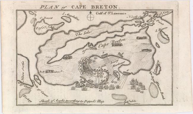
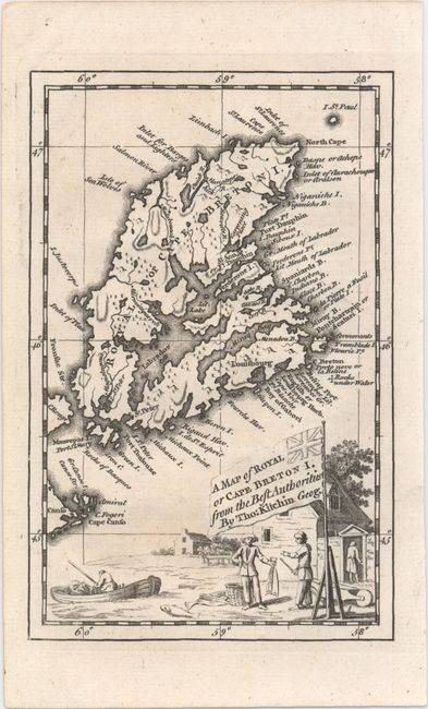
"[Lot of 2] Plan of Cape Breton [and] A Map of Royal or Cape Breton I. from the Best Authorities",

Subject: Cape Breton Island, Canada

Period: 1745-47 (published)

Publication:

Color: Black & White

Size:
See Description
Download High Resolution Image
(or just click on image to launch the Zoom viewer)

A. Plan of Cape Breton, by Anonymous, from Gentleman's & London Magazine, published 1745 (6.5 x 4.0"). This map of the island of Cape Breton in Nova Scotia was published in August 1745, just a couple months after the Siege of Louisbourg during the War of Austrian Succession (or King George's War). The Louisbourg Harbor appears in plan form, with excellent detail of the capital's fortifications and a number of ships filling the waters. Outside Louisbourg there is little detail on the rest of the island, with the exception of scattered settlements depicted as rows of buildings. Some surrounding islands are shown, and for some reason, Newfoundland is nearly touching Cape Breton. A note at the bottom reads, "Shoals of Acadie according to Poppel's map." There are 17 numbered sites with a key on an opposing page (not included here). Condition: There are three tiny binding holes in the bottom blank margin. B. A Map of Royal or Cape Breton I. from the Best Authorities, by Thomas Kitchin, from London Magazine, published 1747 (4.2 x 6.5"). This map details the entire island with many names along the coast. The lower portion of the map is filled with a trading post scene, complete with a boat, fishermen, and trader. The tiny St. Paul Island appears as well. The title is contained in a unique British flag cartouche. Kitchin began his career in 1745, making this an early example of his work. Condition: A dark impression.

References: Jolly #GAL-5 & #LOND-22; Kershaw #867 & #870.

Condition: A

See descriptions above.

Estimate: $140 - $180

Sold for: $120

Closed on 9/17/2014

Archived