Catalog Archive
Auction 149, Lot 85

"L'Amerique Septentrionale Divisee en Ses Principaux Etats", Janvier/Lattre
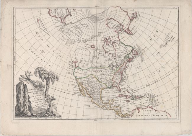
Subject: North America

Period: 1762 (dated)

Publication: Atlas Moderne

Color: Hand Color

Size:
17.6 x 12 inches
44.7 x 30.5 cm
Download High Resolution Image
(or just click on image to launch the Zoom viewer)

This is one of the more interesting transitional states of this great 18th century map. The map was first issued in 1762 with an extensive network of rivers and lakes in present-day Canada that hinted at the possibility of a Northwest Passage. This edition retains the 1762 date in the cartouche, but the map has been significantly re-engraved. The potential passage has been erased and a confused group of islands and notations about the Russian discoveries are now depicted in the region of Alaska. The salient feature is still the gigantic, and entirely mythical Sea the West, near modern-day Seattle, connected to the Pacific by the straits of Juan de Fuca and Martin d' Aguilar. New Albion is on the southwest shore of this great inland sea, which inundates virtually all of present-day British Columbia and Alberta. The British Colonies are still confined east of the Appalachian Mountains with French Louisiana stretching to the Pacific Northwest. Ft. Cenis and Santa Fe are visible within the Spanish territories in the southwest, labeled Nouveau Mexique here. The large, decorative title cartouche, incorporating a palm tree and grape vines, was engraved by Berthault.

References: Sellers & Van Ee #94.

Condition: B+

On watermarked paper with light soiling including a few manuscript notes. A couple short edge tears and one chip in the blank margins have been archivally repaired.

Estimate: $500 - $700

Unsold

Closed on 5/21/2014

Archived