Catalog Archive
Auction 149, Lot 733

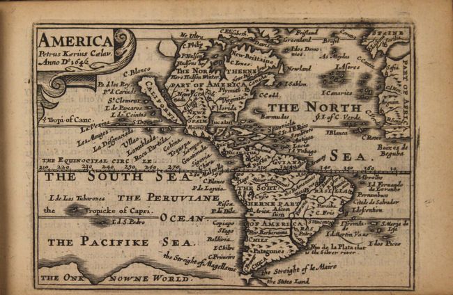
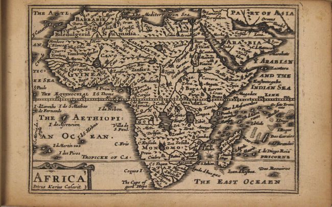
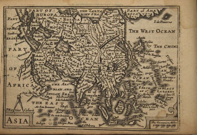
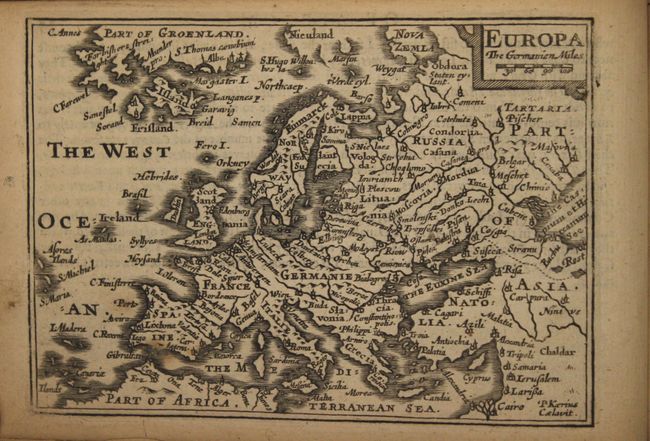
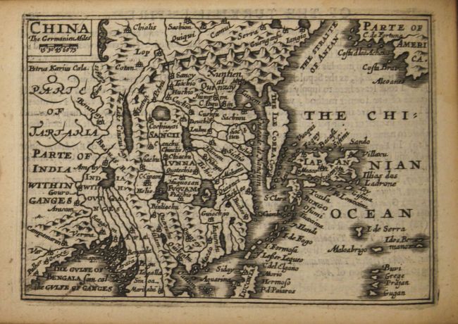
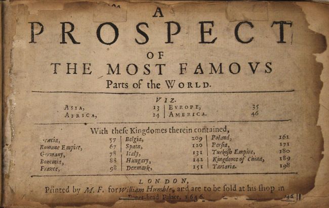
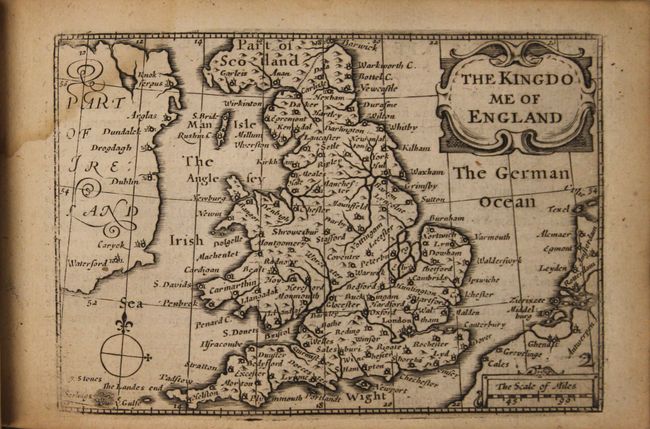
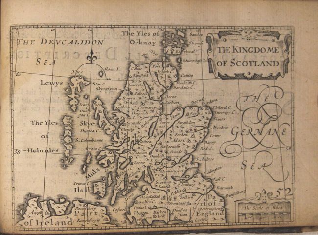
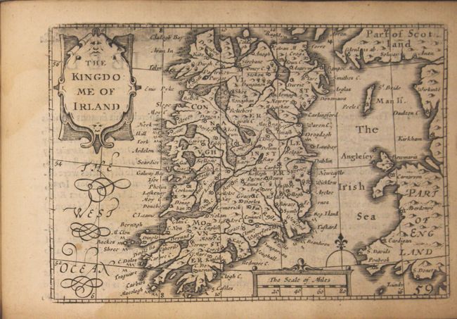
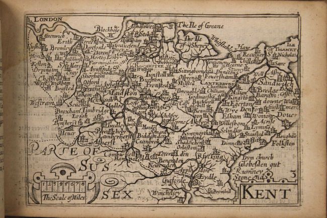
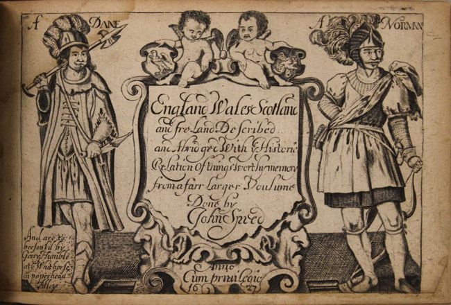
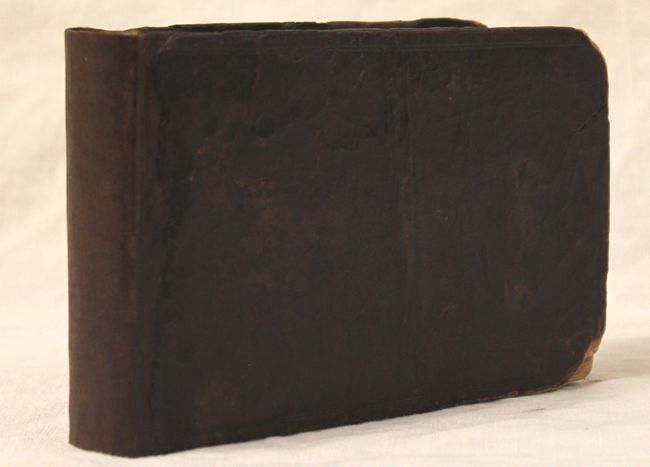
First Edition of the Miniature Speed Dual Atlas

"A Prospect of the Most Famous Parts of the World [bound with] England Wales Scotland and Ireland Described…", Speed/Kaerius

Subject: Atlases

Period: 1627-46 (dated)

Publication:

Color: Black & White

Size:
6.6 x 4.3 inches
16.8 x 10.9 cm
Download High Resolution Image
(or just click on image to launch the Zoom viewer)

This handsome miniature atlas is famously known as the "miniature Speed" atlas since the maps, engraved by Pieter van den Keere, were based on John Speed's folio-sized maps published under the same title, A Prospect of the Most Famous Parts of the World. This example is a dual atlas containing both the world atlas and an atlas of the British Isles. Both atlases had an interesting publication history, beginning with the atlas of the British Isles, which was first published between 1605 and 1610. In 1619, the British Isles maps came into the hands of London printer George Humble, who included additional maps and reprinted them under the name of John Speed, thereby initiating the popular series of "miniature Speed" atlases. George Humble had published the first edition of John Speed's folio-sized Theatre of the Empire of Great Britain in 1612 and A Prospect in 1627, both of which saw great success. The first edition of the miniature Prospect atlas appeared in 1646 published by George Humble's son, William Humble, and was sometimes bound separately from the British Isles atlas and sometimes bound in a dual atlas.

The miniature maps in A Prospect were engraved by Van den Keere while in his 70's, and are believed the be the last maps engraved by him before his death at the age of 75. The atlas contains 19 of 20 maps: Asia, Africa, Europe, Americas, eleven maps of European countries, Persia, the Turkish Empire, China and Tartary. (The world map is perished.) Each of the maps is single page with text on verso taken from Speed's folio atlas, and all are signed with Van den Keere's Latinized name, Petrus Kaerius. The simple, typographic title page contains the list of maps and is dated 1646 with the imprint of William Humble. The western hemisphere map, America, depicts California as an island with a flat northern coast and several place names. The cartography of this map is based on Goos' folio map from 1626, and omits any French presence in Canada. Newe Ing. Land is located north of the St. Lawrence River, and Plymuth is the only European settlement depicted. Interestingly, in this example the printer accidentally printed the map of the Low Countries on the verso of the page of text describing Germany. He corrected the error by printing the map of Germany on a separate sheet, and then pasting it on top of the map of the Low Countries (which also correctly appears later in the atlas).

There are 62 (of 63) maps in England Wales Scotland and Ireland, including separate maps of England, Wales, Scotland and Ireland, and 58 county maps. (The folding map of the British Isles is not included.) The majority of the British Isles maps were also engraved by Van den Keere and were based on Saxton for the English and Welsh county maps, on Ortelius for the Scottish maps, and on Van den Keere's own map of Ireland for the Irish maps. It is believed that the map of England was not engraved by Van den Keere, but was commissioned by Humble for the 1627 edition and was based on Speed's folio map, omitting the costumed figures. The text in this atlas was derived from Speed's Theatre of the Empire of Great Britain. The title page is dated 1627 with the imprint of George Humble and features two putti, a Dane and a Norman.

This is the first edition of the dual atlas to be published. Oblong octavo. New linen spine with original leather boards.

The provenance of this atlas is quite fascinating, as it comes from a direct descendent of the cartographer John Speed. The Speed family believes the atlas was purchased in the 1800's and then passed down from generation to generation. This is the second of only two atlases consigned by the Speed family.

References: Shirley (BL Atlases) T.KEE-1i; McLaughlin #8; Burden #268; Shirley (BI to 1650) #395.

Condition: B+

Condition code is for the maps, which are all in very good to near fine condition (with the exception of the world map, which has perished) with very light toning on some. There is a light damp stain in the gutter at top, entering the top corner of a few maps. The folding map of Yorkshire has a very small rust hole and stain. There are chips along the edges of the first and last few pages, including the <i>Prospect</i> title page. The <i>England</i> title page is remargined at bottom and has a few pencil markings. Original covers are moderately worn with a repaired crack on the back cover and the corners are bumped and chipped.

Estimate: $2,000 - $2,400

Sold for: $4,000

Closed on 5/21/2014

Archived