Catalog Archive
Auction 149, Lot 700

The Earliest Chart of the Coast of Queensland

"Chart of Part of the Coast of New South Wales, from Cape Tribulation to Endeavour Straits", Cook, James (Capt.)

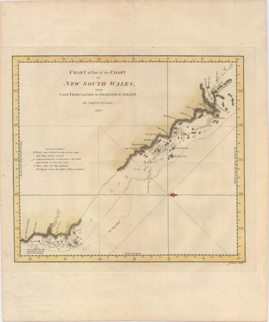
Subject: Northern Australia

Period: 1770 (dated)

Publication: An Account of the Voyages Undertaken by the Order of his Present Majesty…

Color: Hand Color

Size:
13.2 x 11.8 inches
33.5 x 30 cm
Download High Resolution Image
(or just click on image to launch the Zoom viewer)

Captain James Cook (1728-1779) is best known for his three voyages to the Pacific (1768-71; 1772-75; and 1776-79). His discoveries radically changed the western understanding of the world in the late 18th century. He was the first to circumnavigate and chart New Zealand and provided the earliest European accounts of exploration along the eastern coast of Australia and the Hawaiian Islands. On February 14th, 1779, he was killed on Hawaii after attempting to kidnap the chief of the island.

Many contemporary accounts of Cook’s voyages, including charts and engravings, appeared in the late 18th century. The first official account of Cook’s first voyage was published in 1773 by John Hawkesworth in Volumes II and III of An Account of the Voyages Undertaken by the Order of His Present Majesty for Making Discoveries in the Southern Hemisphere... William Strahan and Thomas Cadell published the first official accounts of the second and third voyages in 1777 and 1784. Accounts of his exploration were subsequently translated into French, German, and Dutch.

This map outlines the eastern shore of Cape York from Cape Tribulation to the Endeavour Strait at the northern tip. The track of Captain Cook's ship from his first voyage to the South Pacific is shown. The anchorages of the Endeavour are depicted, along with rocks, shoals, and soundings. A notation near Cape Tribulation identifies where the ship "laid 23 hours, and received much damage." A fleur-de-lis orients north to the right. This map appeared in John Hawkesworth's An Account of the Voyages Undertaken by the Order of his Present Majesty for Making Discoveries in the Southern Hemisphere..., which details the explorations of Commodore Byron, Captain Wallis, Captain Carteret, and Captain Cook. Engraved by J. Cheevers and published in 1773 by W. Strahan and T. Cadell.

References: Tooley (Australia) p. 235, #5; Shirley (BL Atlases) G.HAWK-1a #27.

Condition: A

A fine impression, issued folding, with marginal soiling.

Estimate: $400 - $500

Sold for: $850

Closed on 5/21/2014

Archived