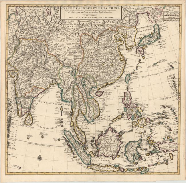
"Carte des Indes et de la Chine Dressee sur Plusieurs Relations Particulieres Rectifiees par Quelques Observations", Delisle/Covens & Mortier
Subject: Eastern and Southern Asia
Period: 1730 (circa)
Publication:
Color: Hand Color
Size:
24.6 x 24 inches
62.5 x 61 cm
This large, attractive map covers the vast region extensively explored by the Europeans with particular emphasis on the trade routes on the mainland and the islands of the Philippines and the East Indies. In Japan, Hokkaido (Terre d' Yeco ou d'Eso) is attached to the Asian mainland, and the Sea of Japan is named Mer Orientale ou Mer de Coree. Korea is correctly shown as a peninsula, although much too wide. The mythical Lac de Chiamay appears in present-day Burma with several rivers flowing south. The map is filled with details of towns, roads, rivers and topography. Two sheets, joined, as issued.
References:
Condition: A
A fine impression with original color on watermarked paper. Issued folding with a tiny hole at the fold intersection and minor mis-folds along the bottom fold.