Catalog Archive
Auction 149, Lot 591

"La Romelie et les Environs de Constantinople", Santini, P.
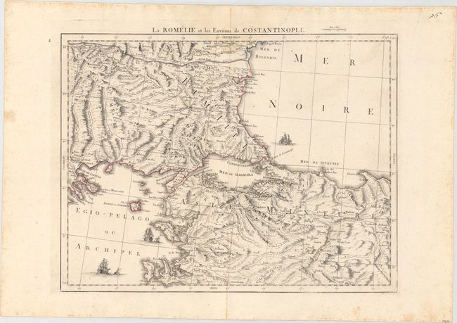
Subject: Turkey

Period: 1778 (circa)

Publication:

Color: Hand Color

Size:
21.9 x 17.1 inches
55.6 x 43.4 cm
Download High Resolution Image
(or just click on image to launch the Zoom viewer)

Attractive map of Turkey centered on Istanbul that covers the region from Sophia to Kutahya with good detail of topographical features and the river system. The map is adorned by three sailing ships and a distance scale above the imprint.

References:

Condition: B+

A dark impression with light scattered foxing and a damp stain that just passes the border at top.

Estimate: $200 - $250

Sold for: $70

Closed on 5/21/2014

Archived