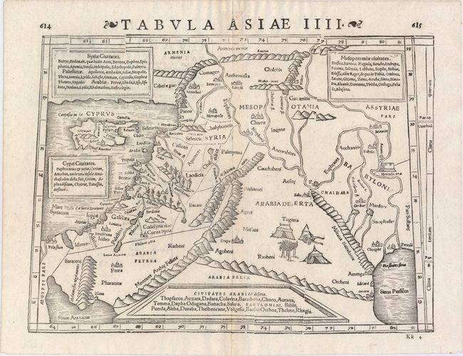
"Tabula Asiae IIII", Munster/Petri
Subject: Middle East & Cyprus
Period: 1571 (published)
Publication: Strabonis Rerum Geographicarum...
Color: Black & White
Size:
13.6 x 10.6 inches
34.5 x 26.9 cm
Woodblock Ptolemaic map of the Middle East from present-day Iraq and the Tigris and Euphrates Rivers westward to the Mediterranean Sea and the island of Cyprus. A Bedouin encampment is shown in the interior of Arabia Deserta. The shoreline of the Holy Land runs from Ptolemais (Acco) as far as Ascalon. There is a nonexistent bay north of Acco and also north of Jaffa. There are four text boxes describing Syria, Mesopotamia, Cyprus and Arabia. From an edition of Strabo's Geographica published by Heinricus Petrus in 1571. Latin text on verso.
References: Laor #615.
Condition: A
A clean, bright example with a hint of toning along the centerfold and very minor show-through of text on verso. A few small wormholes appear near the centerfold in the blank margins.