"Map and Description of the Principal Mountains, &c. Throughout the World", Carey & Lea
Subject: Cartographic Miscellany
Period: 1822 (circa)
Publication: A Complete Historical, Chronological, and Geographical American Atlas...
Color: Black & White
Size:
13.5 x 12.3 inches
34.3 x 31.2 cm
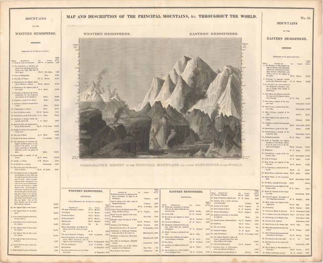
This fascinating chart features numbered illustrations of mountains, volcanoes, and towns from across the globe depicted side by side for easy comparison. The numbers correspond with the lists surrounding the chart, which identify the location pictured and its elevation. A dotted line divides the chart by hemisphere. At 21,440 feet above sea level, Chimborazo in the Andes is the highest peak noted in the Western Hemisphere, while in the east the highest summits of the Himalayas tower above the pack, reaching an altitude of 27,677 feet. On a full folio sheet with text measuring 20.5 x 16.7", with an alternate title, Comparative Height of the Principal Mountains and Other Elevations in the World, running below the chart. Arranged by Fielding Lucas, Jr. and engraved by Young & Delleker.
References:
Condition: A
There are a few faint spots within the image and small damp stains confined to the blank margins.