"[Lot of 3] Sweden, Denmark, Norway, and Iceland &c. [and] Sweden, Denmark, and Norway [and] Sweden and Norway",
Subject: Scandinavia
Period: 1800-60 (circa)
Publication:
Color: Black & White
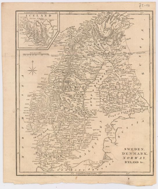
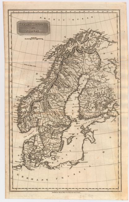
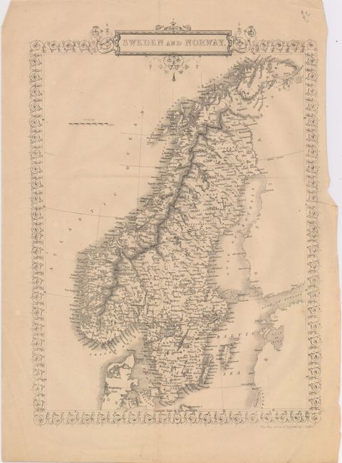
This lot of three maps shows Sweden, Norway, Denmark and Iceland during the nineteenth century, depicting towns, rivers, topography, and political divisions.
A. Sweden, Denmark, Norway, and Iceland &c., by Robert Wilkinson, circa 1800 (9 x 10.8"). Condition: Issued folding, now pressed, with minor offsetting and soiling, and one tiny worm hole only visible when held to light.
B. Sweden, Denmark, and Norway, By Thomas Kelly, from A New and Comprehensive Gazetteer, circa 1818 (9.5 x 15.4"). Condition: Issued folding on watermarked paper with light offsetting and toning.
C. Sweden and Norway, by John Rapkin, from The Royal Dictionary Cyclopaedia for Universal Reference, published by Thomas Wright, circa 1860 (9.5 x 13.5"). This map is nearly identical to the one that Rapkin engraved for Tallis, although without the vignettes surrounding the map. Condition: Issued folding with a couple of minor spots and a few minute worm holes only visible when held to light.
References:
Condition: B+
See description above.