Catalog Archive
Auction 149, Lot 441

"A New & Accurate Map of North Wales, Drawn from a Late Survey", Anon.

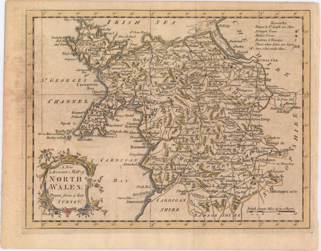
Subject: Northern Wales

Period: 1766 (published)

Publication: Universal Magazine

Color: Hand Color

Size:
9.3 x 7.2 inches
23.6 x 18.3 cm
Download High Resolution Image
(or just click on image to launch the Zoom viewer)

This detailed map details six historic counties in northern Wales, from Anglesey down to Montgomeryshire. Roads, castles, rivers, and bays are identified, and cities, rectories, vicarages, fairs, and borough and market towns are indicated by symbols explained in a key at top right. A decorative title cartouche adorns the bottom left corner.

References: Jolly #UNIV-126.

Condition: B

Issued folding on a slightly toned sheet with light offsetting and some soiling mostly concentrated just outside the neatline at left.

Estimate: $100 - $130

Sold for: $60

Closed on 5/21/2014

Archived