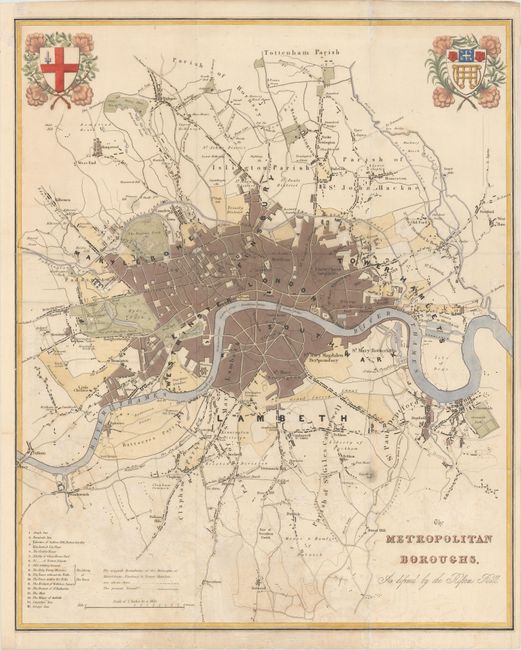
"The Metropolitan Boroughs, as Defined by the Reform Bill", Dawson, Robert Kearsley
Subject: London, England
Period: 1832 (circa)
Publication: County Maps & City Plans of England & Wales
Color: Hand Color
Size:
19.6 x 24 inches
49.8 x 61 cm
The Electoral Reform Act of 1832 created the metropolitan boroughs of London as depicted on this finely drawn plan that extends from Tottenham in the north, West Ham in the east, south to Norwood and west to Kensington. The River Thames is depicted flowing through the center of London from Greenwich to Battersea, Wandsworth, and Fulham. At bottom left is an explanation of the boundary lines and a list of 'liberties' - the name given to areas exempt from the jurisdiction of the country sheriff, being subject to a separate commission of the peace (in this case royal and governmental authorities). The upper corners are decorated with the arms of the City of London and the City of Westminster, both embellished with floral sprays.
References:
Condition: B+
Issued folding with light offsetting concentrated in the lower half of the image and some short fold separations, most of which have been closed with archival materials. The sheet has been remargined at left to accommodate framing.