Catalog Archive
Auction 149, Lot 417

"Tabula Britanniae", Munster/Petri
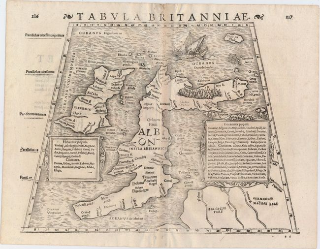
Subject: Britain

Period: 1621 (published)

Publication: Strabonis Rerum Geographicarum...

Color: Black & White

Size:
13.6 x 10.7 inches
34.5 x 27.2 cm
Download High Resolution Image
(or just click on image to launch the Zoom viewer)

This uncommon and striking Ptolemaic map of the British Isles comes from an edition of Strabo's Geographica published by Heinricus Petrus. As is typical, the woodcut map appears within a trapezoidal frame and includes fascinating misconceptions about the geography of the area. Among these inaccuracies is an Ireland (Hibernia) that is level with the northern part of Great Britain, and an exaggerated Scotland that extends way too far east. Great Britain is here referred to as both Albion and Insula Britannica. Scotland features the vast Caledonian Forest, which is depicted as a swath of trees. North of Scotland, a ship sails through the wavy seas. Two elegant cartouches list the ancient tribes and settlements of Ireland and Britain. Latin text on verso.

References: Shirley (BI to 1650) #89.

Condition: B+

Faint show-through of the backstrap and text on verso. A couple of infilled worm tracks appear in the blank margins.

Estimate: $750 - $900

Unsold

Closed on 5/21/2014

Archived