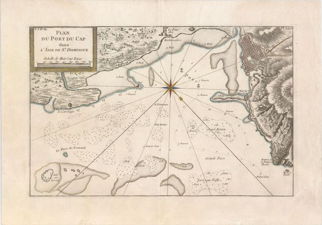
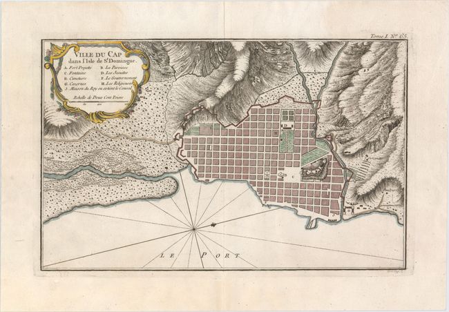
"[Lot of 2] Plan du Port du Cap dans l'Isle de St. Domingue [and] Ville du Cap dans l'Isle de St. Domingue", Bellin, Jacques Nicolas
Subject: Haiti
Period: 1764 (circa)
Publication: Le Petite Atlas Maritime
Color: Hand Color
Size:
14.2 x 9.1 inches
36.1 x 23.1 cm
This fascinating pair of charts focuses on a piece of the coastline of what is today Haiti. Plan du Port du Cap dans l'Isle de St. Domingue features excellent topographical detail along the coast and a small plan of Ville du Cap (modern day Cap-Haitien). In the water depth soundings, hazards, and anchorages are shown. A compass rose topped with a fleur-de-lis orients the north to the bottom right corner. Ville du Cap dans l'Isle de St. Domingue zooms in to center on a plan of Cap-Haitien, with a key in the title cartouche indicating nine sites of interest, such as the fort, cemetery, and a fountain. A compass rose orients the north to the right. Size varies slightly.
References: Sellers & Van Ee #1878-79.
Condition: A
The first chart is on watermarked paper. Both have faint damp stains in the upper blank margins.