NO RESERVE
"[Lot of 2] Carte de l'Isle de Saint Domingue [and] Ville de S. Domingue dans l'Isle de ce Nom", Bellin, Jacques Nicolas
Subject: Hispaniola
Period: 1758-64 (circa)
Publication:
Color: Hand Color
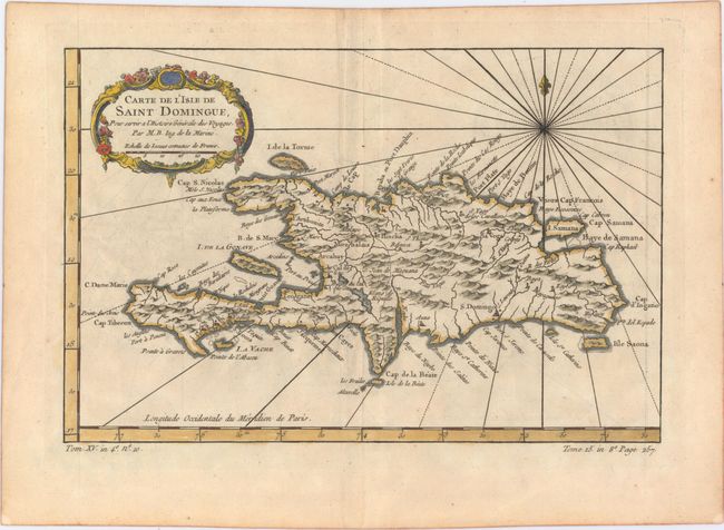
A. Carte de l'Isle de Saint Domingue, from La Harpe's L'Histoire Generale des Voyages, circa 1758 (11.6 x 7.6"). This copper-engraved map of Hispaniola names several capes, ports, and bays running along the coast of the island, as well as identifying numerous towns and rivers inland. A compass rose capped with a fleur-de-lis radiates rhumb lines and a title cartouche draped in garlands adorns the upper left corner. Condition: On watermarked paper with minor offsetting and a hint of toning. (B+)
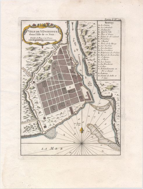
B. Ville de S. Domingue dans l'Isle de ce Nom, from Le Petite Atlas Maritime, circa 1764 (6.4 x 8.7"). This is a very nice street plan of Santo Domingo, the present capital of the Dominican Republic. A legend indicates the location of 22 significant features on the map. Santo Domingo is the oldest continually inhabited European settlement in the Americas, and was at the time of this map's publication a Spanish colonial possession. The chart is embellished with rococo-style cartouche, rhumb lines, and fleur-de-lys. Condition: On watermarked paper. (A)
References: Sellers & Van Ee #1851 & #1908.
Condition:
See description above.